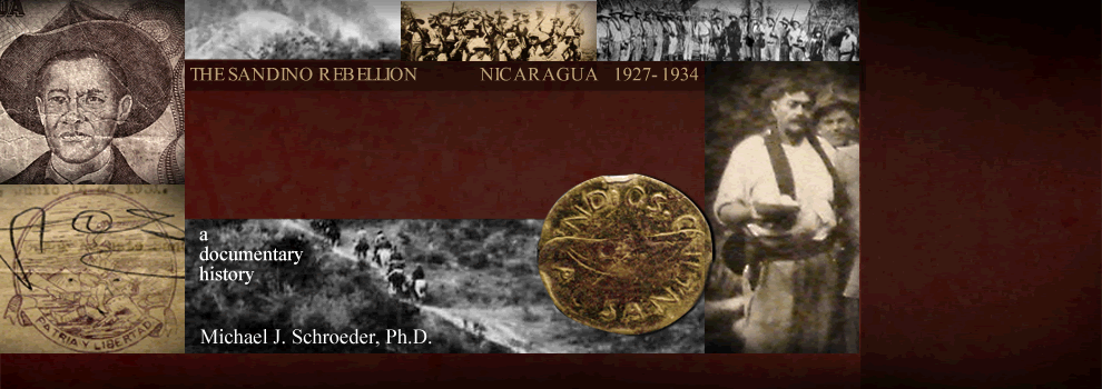
|
 This page
HOUSES THE 1934 US ARMY MAP
that came out of the US occupation
— an exceptionally detailed & sophisticated text
that was years in the making and represented the
culmination of one of the major projects of the
B-2 Intelligence Section. As Major Hans
Schmidt wrote in 1928, "The compilation and
gradual building up of a good map should be [the
Intelligence Section's] primary and lasting
work" (Schmidt memo, 12 Nov.
1928, NA127/43A/4). So it was.
This page
HOUSES THE 1934 US ARMY MAP
that came out of the US occupation
— an exceptionally detailed & sophisticated text
that was years in the making and represented the
culmination of one of the major projects of the
B-2 Intelligence Section. As Major Hans
Schmidt wrote in 1928, "The compilation and
gradual building up of a good map should be [the
Intelligence Section's] primary and lasting
work" (Schmidt memo, 12 Nov.
1928, NA127/43A/4). So it was.
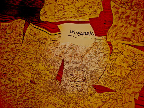
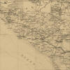
This 1934 US
Army map is housed in the Clark Library
Map Collection in the Harlan Hatcher Graduate
Library at the University of Michigan.
Produced by the Geographic Branch of the US
Army's Military Intelligence Division, it
is comprised of several overlapping maps of
Nicaragua and Honduras, each approximately 3
feet high & 4 feet wide. Photocopied using
the library's large poster-size photocopy
machine, the map was sectioned along its
grid-lines, with each section measuring 8½
inches square and representing 0.5 degrees
longitude & latitude (30 minutes each side).
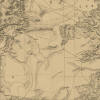
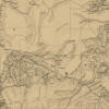
Years
ago I used these sections, more than 50 in all,
to create a digitized version of the map, using
now-obsolete software MapInfo 2.0 and a desktop
digitizing tablet. This digitized version
of the 1934 US Army map has been converted into a zoomable PDF file and is
accessible
HERE. (One needs to
zoom in around 500% in order to read the
smallest lettering.) This PDF map has both
advantages & disadvantages over JPEG
maps. Among the big disadvantages are the tiny
lettering (unless zoomed-in to too small a
scale), and the inability to crop or edit the
image. One big advantage is that place-names
can be searched.
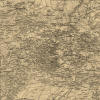
To create the
maps presented here, 47 base-map sections (0.5°
and 2,550 pixels per side) were digitally modified
using Windows Live Photo Gallery and Photoshop
CS5 — cleaning up the images, modifying the hues
& tones, standardizing their size, and in some cases erasing the
latitude-longitude notations made (and bits of
scotch tape put) in the corners during the
digitization process. The maps presented
below are JPEG versions of CS5 files that are in
the process of being modified (place names
corrected, additional place-names inserted,
partial colorizing, and so on).
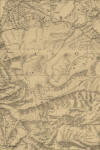
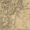
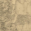
These 47 base-map
sections
were then stitched together into 16 larger
composite maps. The amount of territory
that can be
covered — the number of sections
that can be combined — is
constrained by the size of the digital
files. Each base-map JPEG file takes up about 5.0MB. Ideally
one would create a single map covering all of
northern Nicaragua, but the files simply become
too big (e.g., 4 sections stitched together
becomes 30MB; 6 sections
stitched together becomes 50
MB; any more and the file becomes impractically
big).
The
table below presents each of these 47 base-map
sections. Below that are 16
larger composite maps, most combining four
base-maps, some combining six.
If
you don't find the particular composite map
you're looking for, feel free to pluck off the
ones you want and make your own !
|
|
1 |
2 |
3 |
4 |
5 |
6 |
7 |
8 |
9 |
10 |
|
|
A |
(EMPTY) |
(EMPTY) |
(EMPTY) |
(EMPTY) |
(EMPTY) |
_small.jpg)
Asang |
_small.jpg)
Tilba-Sang Sang |
_small.jpg)
Waspuk-Kisalaya |
_small.jpg)
Ulwas-Sawa Boom |
_small.jpg)
Cabo Gracias a Dios |
A |
|
B |
(EMPTY) |
(EMPTY) |
_small.jpg)
DanlÍ-jalapa |
_small.jpg)
RÍo Coco Hondudras |
_small.jpg)
bocay |
_small.jpg)
Musawas |
_small.jpg)
Englesing's Trail |
_small.jpg)
Logtown-Wawa Boom |
_small.jpg)
Puerto Cabezas |
B |
|
C |
(EMPTY) |
(EMPTY) |
_small.jpg)
YuscarÁn |
_small.jpg)
ApalÍ-el JÍcaro |
_small.jpg)
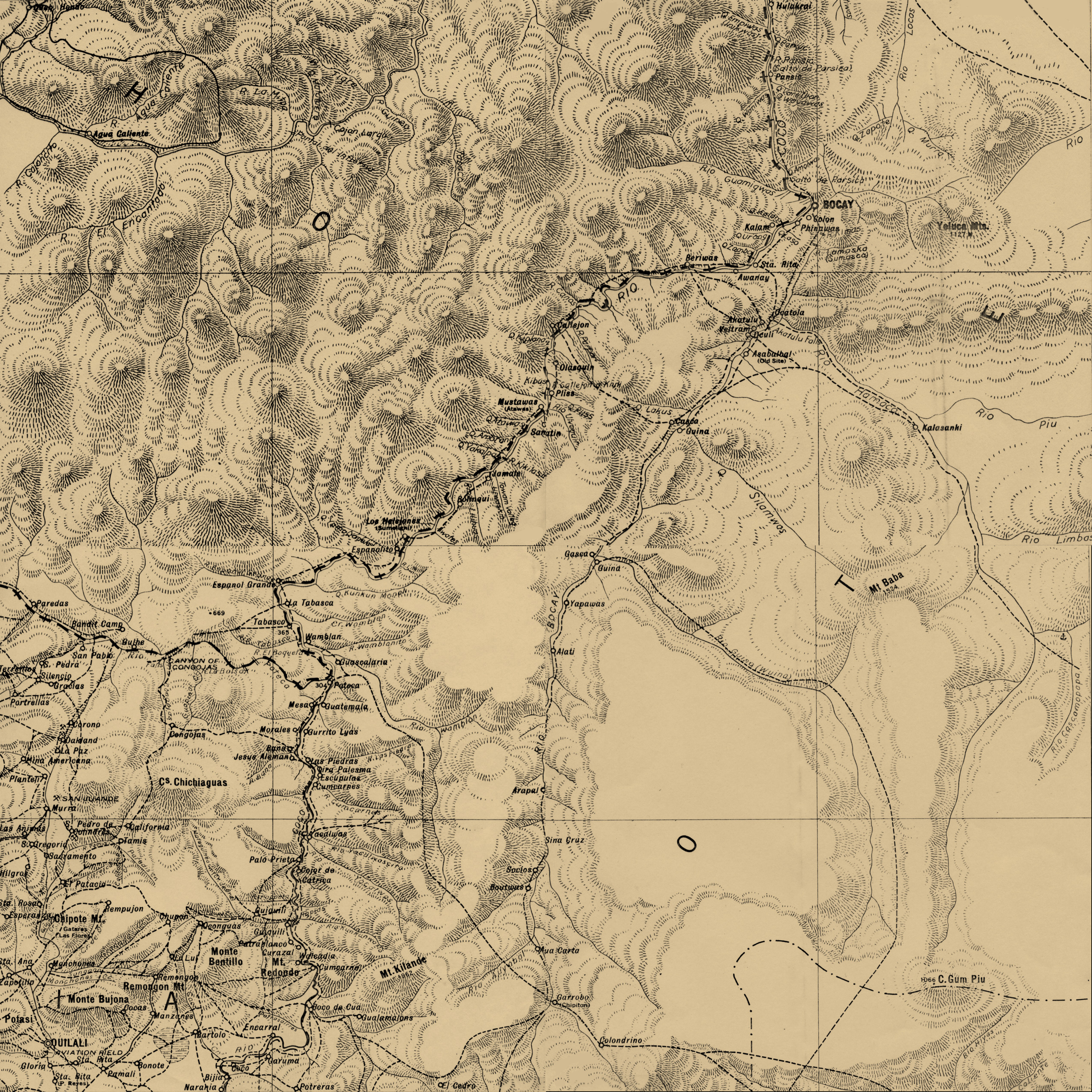
QuilalÍ |
_small.jpg)
garrobo-chipotÓn |
_small.jpg)
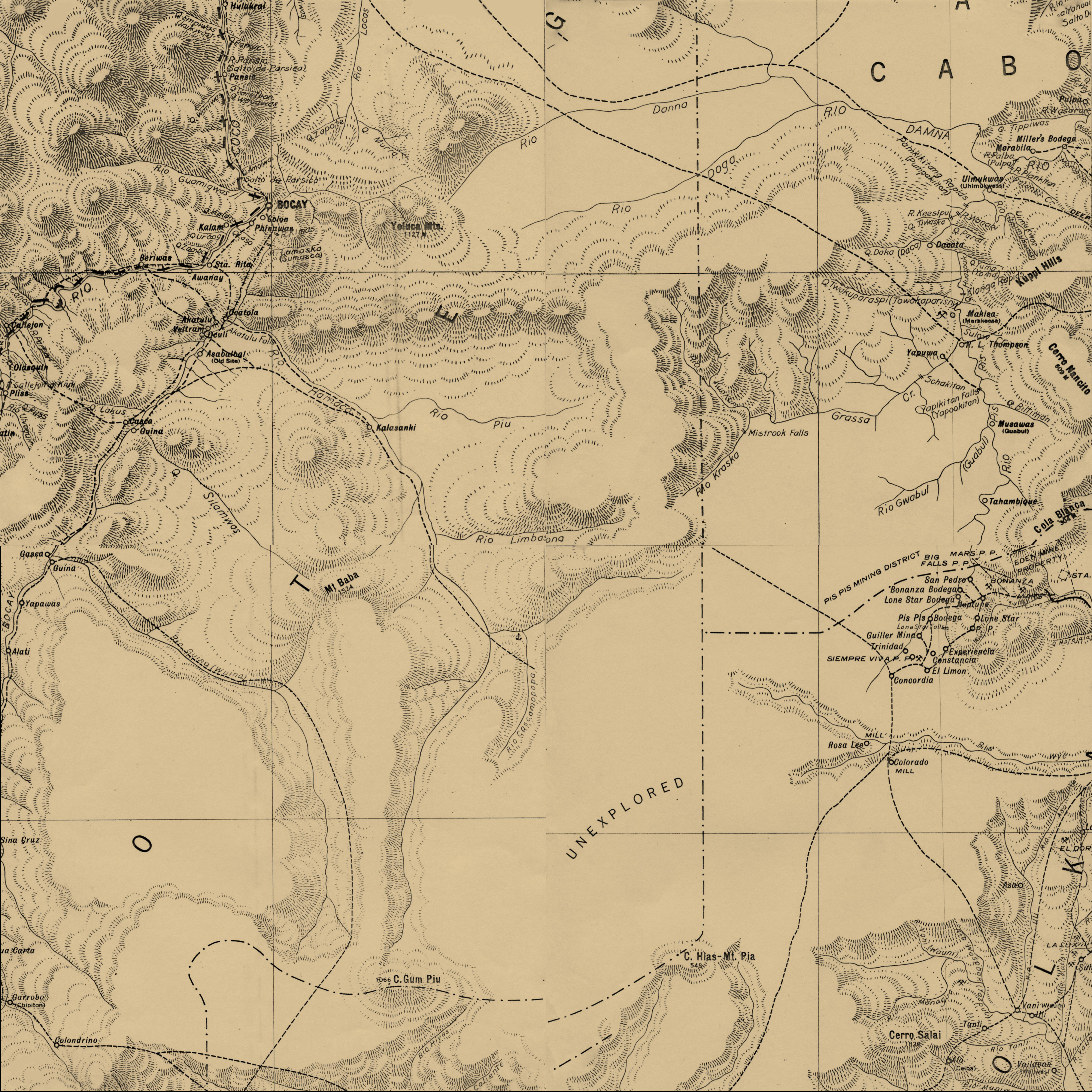
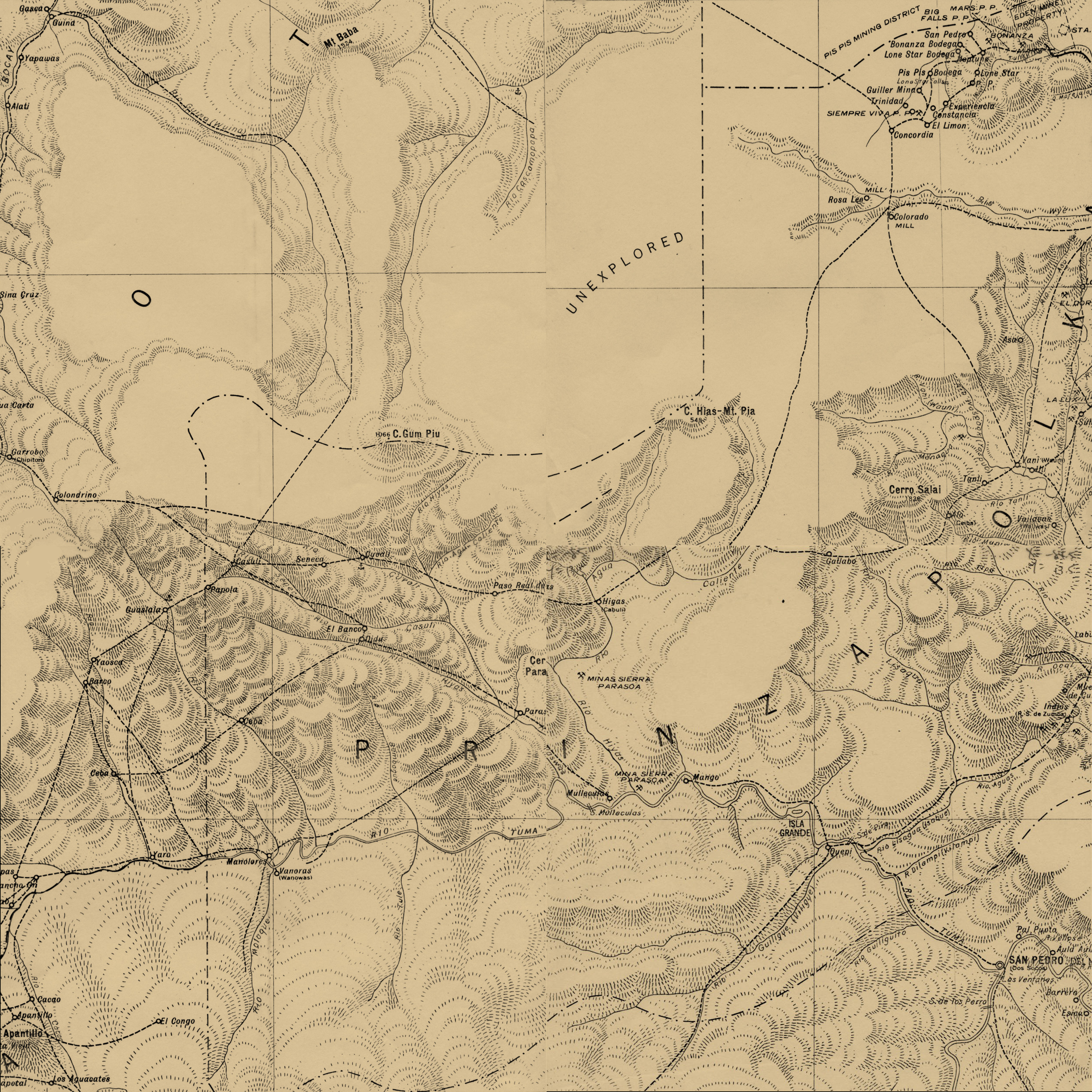
pis pis |
_small.jpg)
tunky |
_small.jpg)
RÍo bambana |
_small.jpg)
rÍo wawa mouth |
C |
|
D |
_small.jpg)
Golfo de fonseca |
_small.jpg)
Choluteca |
_small.jpg)
san marcos de colÓn |
_small.jpg)
estelÍ-JINOTega |
_small.jpg)
RÍO
pantasma |
_small.jpg)
rÍo tuma |
_small.jpg)
san pedro del norte |
_small.jpg)
el gallo |
_small.jpg)
prinzapolka |
(EMPTY) |
D |
|
E |
_small.jpg)
cosegÜina |
_small.jpg)
chinandega |
_small.jpg)
el sauce |
_small.jpg)
san isidro-la trinidad |
_small.jpg)
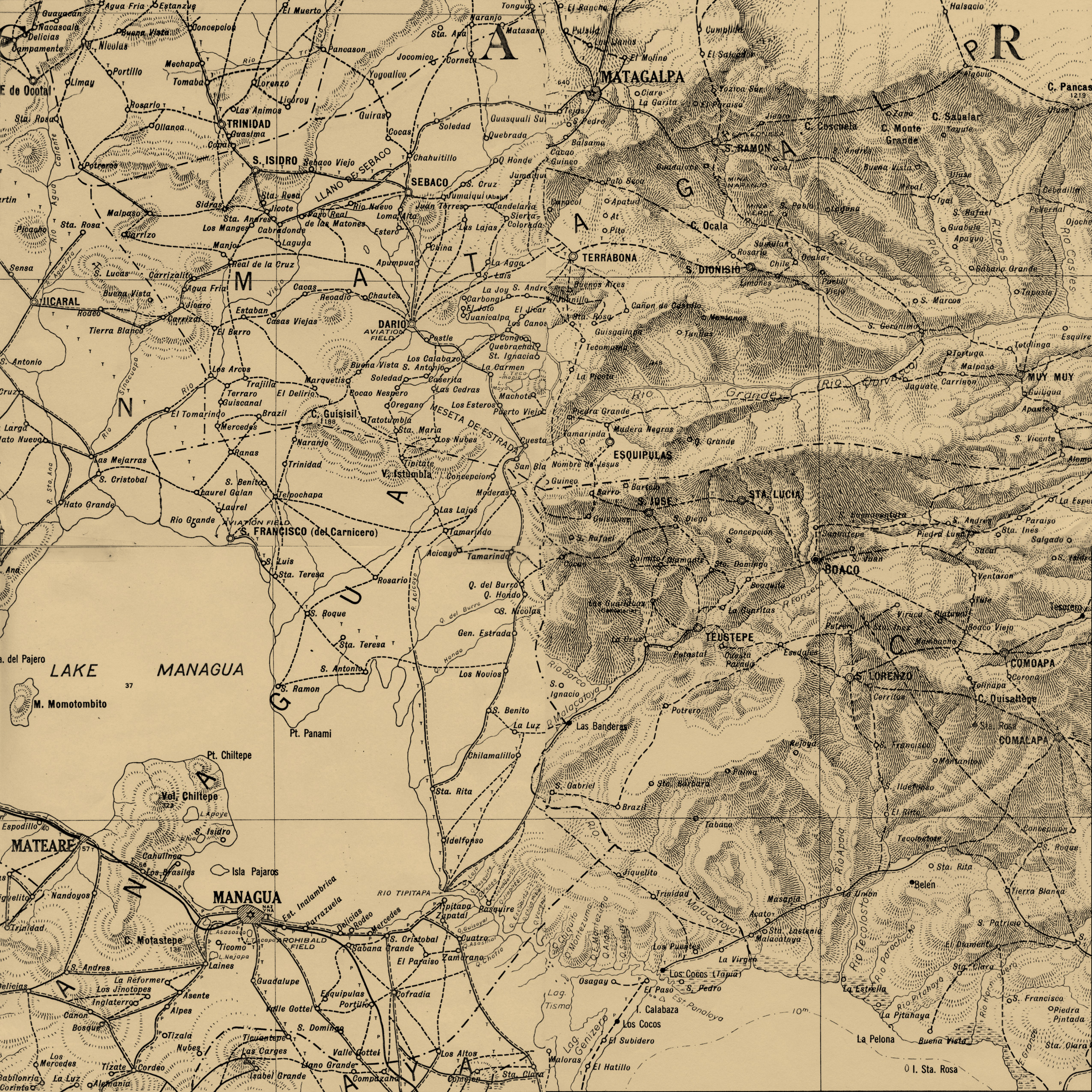
matagalpa-muy muy |
_small.jpg)
matiguÁs |
_small.jpg)
rÍo grande |
_small.jpg)
rÍo kuringwas |
_small.jpg)
laguna de perlas |
(EMPTY) |
E |
|
F |
(EMPTY) |
_small.jpg)
corinto |
_small.jpg)
leÓn |
_small.jpg)
managua |
_small.jpg)
camoapa |
_small.jpg)
juigalpa |
_small.jpg)
rÍo siquÍa |
_small.jpg)
rama |
_small.jpg)
bluefields |
(EMPTY) |
F |
|
|
1 |
2 |
3 |
4 |
5 |
6 |
7 |
8 |
9 |
10 |
|
The legend
for all these maps is thumbnailed here:
_small.jpg)
In what
follows, a series of tables offer composites of
these maps, presented in a series of
tables because some of the map segments overlap
and I can't think of a better way to present
them, given my technical skills & the software
at hand. It's a bit cumbersome &
inelegant, but it works.
ADVISORY:
These are big files
— each of these composite maps is between
20 and
30 MB.
|
c
O M P O S I T E
M A P C O L L E
C T I O N N O .
2 |
|
|
1 |
2 |
3 |
4 |
5 |
6 |
7 |
8 |
9 |
10 |
|
A |
(EMPTY) |
(EMPTY) |
(EMPTY) |
(EMPTY) |
(EMPTY) |
Asang |
Tilba-Sang Sang |
Waspuk-Kisalaya |
Ulwas-Sawa Boom |
Cabo
Gracias a Dios |
|
B |
(EMPTY) |
(EMPTY) |
DanlÍ-jalapa |
RÍo Coco
Hondudras |
 |
Englesing's Trail |
Logtown-Wawa Boom |
Puerto
Cabezas |
|
C |
(EMPTY) |
(EMPTY) |
 |
QuilalÍ |
tunky |
RÍo bambana |
rÍo wawa mouth |
|
D |
Golfo de fonseca |
Choluteca |
RÍO
pantasma |
 |
el gallo |
prinzapolka |
(EMPTY) |
|
E |
cosegÜina |
 |
san isidro-la trinidad |
matagalpa-muy muy |
rÍo kuringwas |
laguna de perlas |
(EMPTY) |
|
F |
(EMPTY) |
managua |
camoapa |
rama |
bluefields |
(EMPTY) |
|
c O M P O S I T E
M A P C O L L E
C T I O N N O .
3 |
|
|
1 |
2 |
3 |
4 |
5 |
6 |
7 |
8 |
9 |
10 |
|
A |
(EMPTY) |
(EMPTY) |
(EMPTY) |
(EMPTY) |
(EMPTY) |
Asang |
Tilba-Sang Sang |
Waspuk-Kisalaya |
Ulwas-Sawa Boom |
Cabo
Gracias a Dios |
|
B |
(EMPTY) |
(EMPTY) |
DanlÍ-jalapa |
RÍo Coco Hondudras |
bocay |
Musawas |
Englesing's Trail |
Logtown-Wawa Boom |
Puerto
Cabezas |
|
C |
(EMPTY) |
(EMPTY) |
YuscarÁn |
ApalÍ-el JÍcaro |
QuilalÍ |
 |
tunky |
RÍo bambana |
rÍo wawa mouth |
|
D |
Golfo de fonseca |
Choluteca |
san marcos de colÓn |
estelÍ-JINOTega |
RÍO
pantasma |
el gallo |
prinzapolka |
(EMPTY) |
|
E |
cosegÜina |
chinandega |
el sauce |
san isidro-la trinidad |
matagalpa-muy muy |
matiguÁs |
rÍo grande |
rÍo kuringwas |
laguna de perlas |
(EMPTY) |
|
F |
(EMPTY) |
corinto |
leÓn |
managua |
camoapa |
juigalpa |
rÍo siquÍa |
rama |
bluefields |
(EMPTY) |
|
c O M P O S I T E
M A P C O L L E
C T I O N N O .
4 |
|
|
1 |
2 |
3 |
4 |
5 |
6 |
7 |
8 |
9 |
10 |
|
A |
(EMPTY) |
(EMPTY) |
(EMPTY) |
(EMPTY) |
(EMPTY) |
asang |
tilba-Sang Sang |
Waspuk-Kisalaya |
Ulwas-Sawa Boom |
Cabo Gracias a Dios |
|
B |
(EMPTY) |
(EMPTY) |
DanlÍ-jalapa |
 |
 |
Logtown-Wawa Boom |
Puerto Cabezas |
|
C |
(EMPTY) |
(EMPTY) |
YuscarÁn |
ApalÍ-el JÍcaro |
RÍo bambana |
rÍo wawa mouth |
|
D |
Golfo de fonseca |
Choluteca |
san marcos de colÓn |
estelÍ-JINOTega |
RÍO
pantasma |
rÍo tuma |
san pedro del norte |
el gallo |
prinzapolka |
(EMPTY) |
|
E |
cosegÜina |
chinandega |
el sauce |
san isidro-la trinidad |
matagalpa-muy muy |
matiguÁs |
rÍo grande |
rÍo kuringwas |
laguna de perlas |
(EMPTY) |
|
F |
(EMPTY) |
corinto |
leÓn |
managua |
camoapa |
juigalpa |
rÍo siquÍa |
rama
|
bluefields |
(EMPTY) |
|
c O M P O S I T E
M A P C O L L E
C T I O N N O .
5 |
|
|
1 |
2 |
3 |
4 |
5 |
6 |
7 |
8 |
9 |
10 |
|
A |
(EMPTY) |
(EMPTY) |
(EMPTY) |
(EMPTY) |
(EMPTY) |
asang |
tilba-Sang Sang |
Waspuk-Kisalaya |
Ulwas-Sawa Boom |
Cabo Gracias a Dios |
|
B |
(EMPTY) |
(EMPTY) |
DanlÍ-jalapa |
RÍo Coco Hondudras |
bocay |
Musawas |
Englesing's Trail |
Logtown-Wawa Boom |
Puerto Cabezas |
|
C |
(EMPTY) |
(EMPTY) |
YuscarÁn |
ApalÍ-el JÍcaro |
 |
pis pis |
tunky |
RÍo bambana |
rÍo wawa mouth |
|
D |
Golfo de fonseca |
Choluteca |
san marcos de colÓn |
estelÍ-JINOTega |
san pedro del norte |
el gallo |
prinzapolka |
(EMPTY) |
|
E |
cosegÜina |
chinandega |
el sauce |
san isidro-la trinidad |
matagalpa-muy muy |
matiguÁs |
rÍo grande |
rÍo kuringwas |
laguna de perlas |
(EMPTY) |
|
F |
(EMPTY) |
corinto |
leÓn |
managua |
camoapa |
juigalpa |
rÍo siquÍa |
rama
|
bluefields |
(EMPTY) |
It is
noteworthy that Orient Bolívar Juárez, in his recent history of
cartography in Nicaragua, Historia
de la Geodesia y la Cartografía en Nicaragua
(Managua: Ediciones Jano, 2010), pays scant
attention to these and similar maps created by
the US military during the US occupation.
By 1934 when this map was completed, the cartographic technology
used to create it was rapidly becoming obsolete. Within
the decade, aerial photography would dispace the
methods used to create this map. Building
this map, the Intelligence Section built on a
base of on existing maps (in this case mainly
the 1924 Clifford Ham Map and the 1928 Christian
Brothers Nicaraguan geography book), compiling &
integrating the maps & notes of field
commanders, and similar methods. As
"primitive" as these pre-aerial-photography
techniques might have been, the US military used
them to great effect in Nicaragua to create this
remarkably detailed and useful map.
|
.jpg)
.jpg)
.jpg)
.jpg)
.jpg)
.jpg)
.jpg)
.jpg)
.jpg)
.jpg)
.jpg)
.jpg)
.jpg)
.jpg)
.jpg)
.jpg)
.jpg)
.jpg)
.jpg)
.jpg)
.jpg)
.jpg)
.jpg)
.jpg)
.jpg)
.jpg)
.jpg)
.jpg)
.jpg)
.jpg)
.jpg)
.jpg)
.jpg)
.jpg)
.jpg)
.jpg)
.jpg)
.jpg)
.jpg)
.jpg)
.jpg)
.jpg)
.jpg)
.jpg)
.jpg)
.jpg)