|
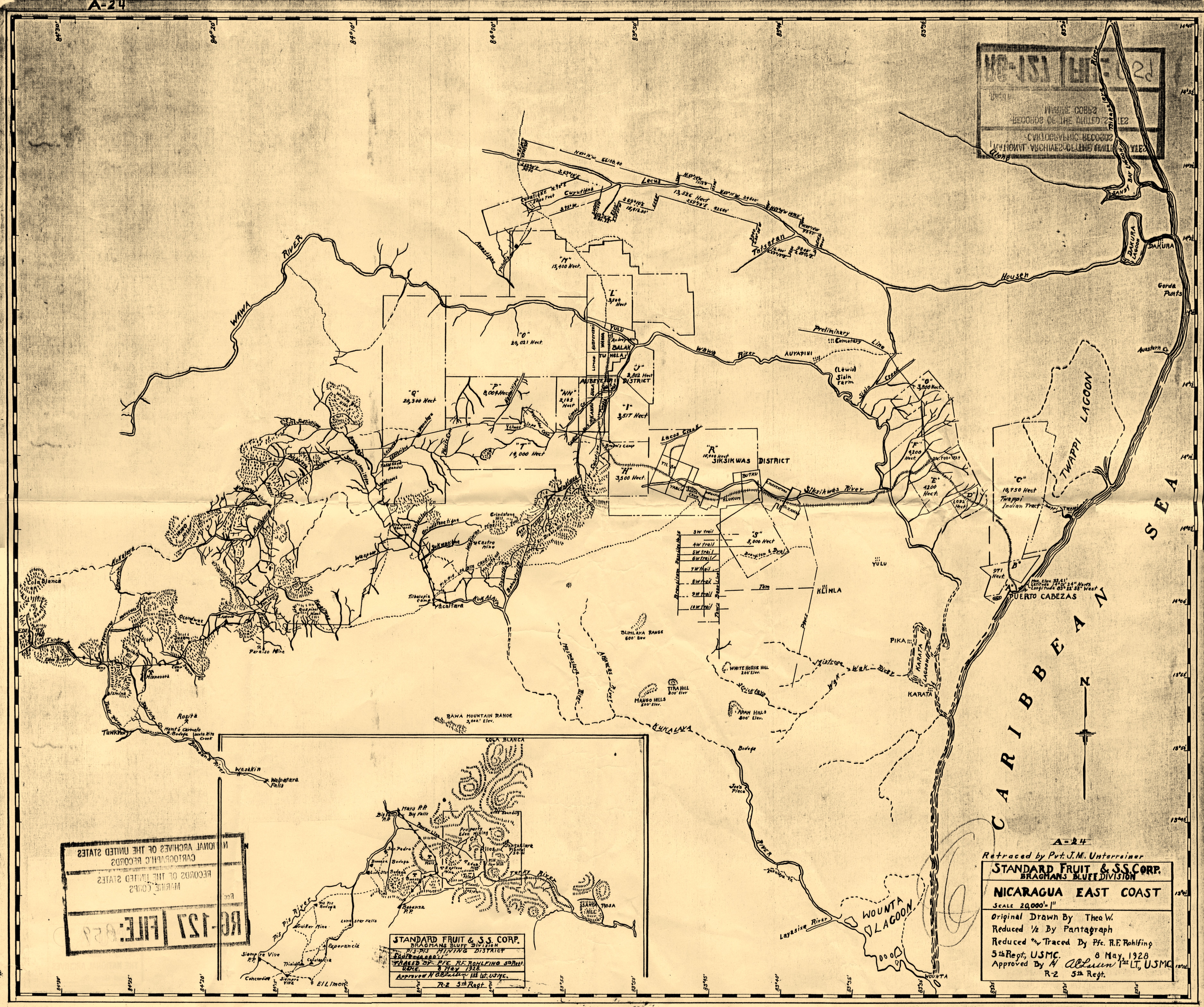
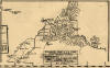
 This page houses
a map of nicaragua's atlantic coast region dated 8
may 1928. As
can be seen in the legend to the right, the US
Marines made this map by reducing & tracing an
original map produced by the Bragmans Bluff
Division of the Standard Fruit & Steamship
Company. It is very likely that the
order to produce a small, compact, useful map of the
East Coast region and the mining districts
resulted directly from the surprise Sandinista
offensive into the Pis Pis & La Luz mining
districts a month earlier, commencing in
mid-April 1928, as seen in the
EAST
COAST PAGES, where this map
is also housed. This page houses
a map of nicaragua's atlantic coast region dated 8
may 1928. As
can be seen in the legend to the right, the US
Marines made this map by reducing & tracing an
original map produced by the Bragmans Bluff
Division of the Standard Fruit & Steamship
Company. It is very likely that the
order to produce a small, compact, useful map of the
East Coast region and the mining districts
resulted directly from the surprise Sandinista
offensive into the Pis Pis & La Luz mining
districts a month earlier, commencing in
mid-April 1928, as seen in the
EAST
COAST PAGES, where this map
is also housed.
This map is
especially useful for its depiction of
the plots of land ceded to private companies,
mostly Bragmans Bluff Lumber Company, for their
banana-growing & lumbering operations. A
JPEG file containing the whole map is followed
by a colorized version that helps one to
visualize more clearly those zones devoted to
production of bananas & lumber for export.
The original map is housed in
RG127 in Archives II in College Park, MD and
measures 21" high x 25" wide. The map
presented here is a panoramic JPEG stitch of scans of
a photocopy.
|
|
Nicaragua East Coast, U.S.
Marine Corps, 8 May 1928.
File size: 10.4 MB.
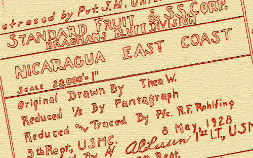
Full
text of legend reads: "A-24
¶ Retraced by Pvt. J. M.
Unterreiner ¶ STANDARD FRUIT
& SS. CORP. ¶ BRAGMANS BLUFF
DIVISION ¶ NICARAGUA EAST
COAST ¶ SCALE 20,000' = 1"
¶ Original Drawn by Theo. W.
¶ Reduced ½ by Pantagraph 
Reduced and traced By Pfc. Rohlfing
¶ 5th Regt., USMC. 8 May, 1928.
¶ Approved by /s/ A.
C. Larsen, 1st LT., USMC. 
R-2 5th Regt.".
|
|
forthcoming
|
Colorized Version
(forthcoming)
|
|
|
Detail: "Pis
Pis Mining District.
"Standard Fruit & S.S. Corp., Bragmans
Bluff Division, traced by Pfc. R. F.
Rohlfing, 5th Regt., U.S.M.C., 8 May
1928"
|
|
|
|
|