|
 This page houses maps produced by the author.
Right now it includes only three of the many
I've made (some others appear in my
dissertation). The most
substantial is the PDF file of the digitized
version of the 1934 US Army map, which took
about six months to create —
cutting the 1934 map along its gridlines into
sections of 30 seconds square (0.5º longitude &
0.5º lattitude), taping sequential sections to a
manual digitizing tablet, and using the software
MapInfo 2.0 to reproduce as accurately as
possible all the text & symbols in the original.
Chunks of this map have been extracted & turned
into JPEG files, and appear immediately below
the big PDF map. This page houses maps produced by the author.
Right now it includes only three of the many
I've made (some others appear in my
dissertation). The most
substantial is the PDF file of the digitized
version of the 1934 US Army map, which took
about six months to create —
cutting the 1934 map along its gridlines into
sections of 30 seconds square (0.5º longitude &
0.5º lattitude), taping sequential sections to a
manual digitizing tablet, and using the software
MapInfo 2.0 to reproduce as accurately as
possible all the text & symbols in the original.
Chunks of this map have been extracted & turned
into JPEG files, and appear immediately below
the big PDF map.
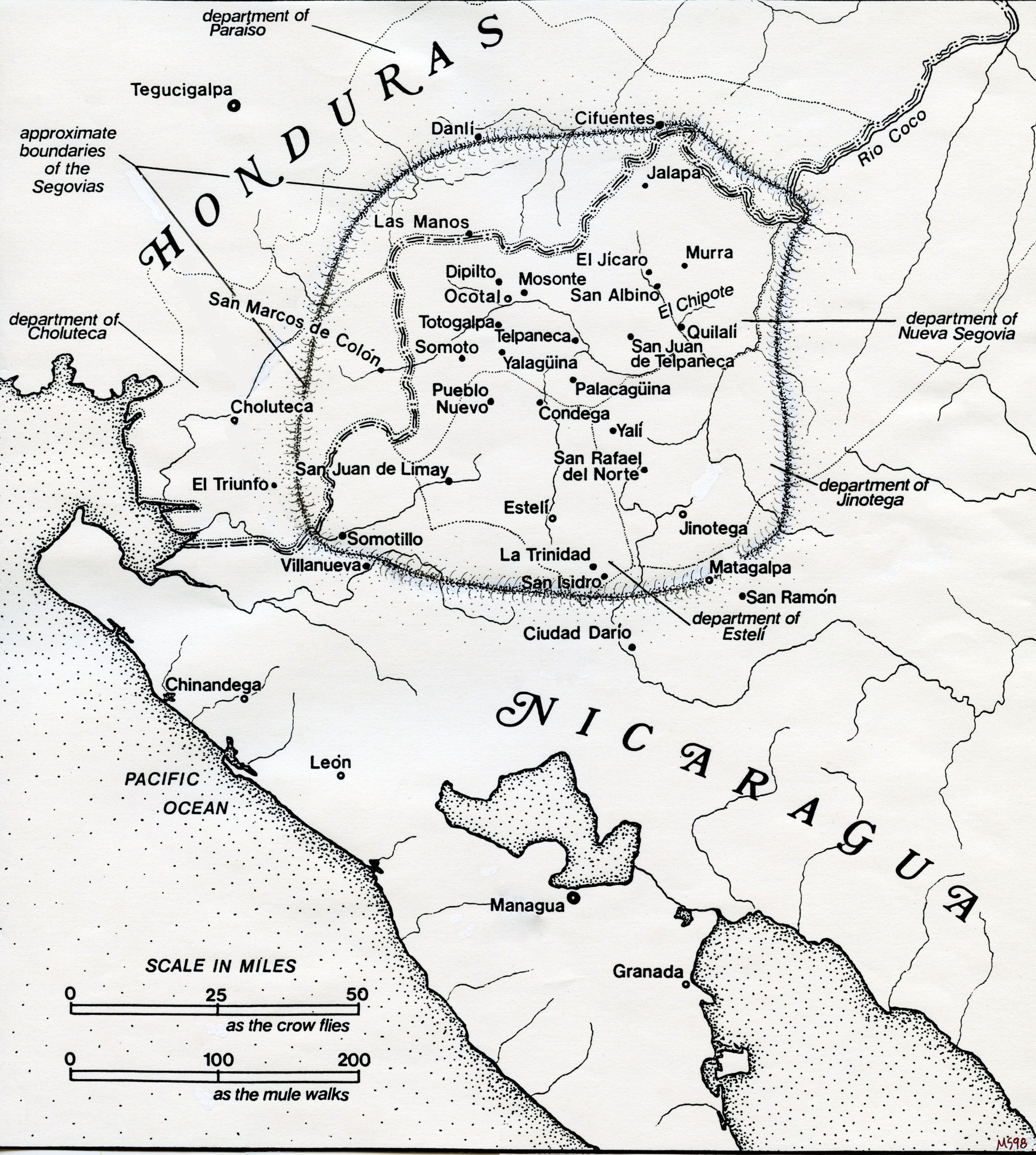
The second map,
showing Las Segovias, was made
in the pre-digital age using a pen and rub-on
letters (and a fair amount of liquid paper;
photoshopped detail at right).
The third shows the airfields built in Western
Nicaragua during the US occupation.
|

|
Map 1. Zoomable
PDF file of a digitized version of the
1934 US Army map, made using MapInfo
Professional 2.0 with a manual
digitizing tablet (a separate page is
devoted to this 1934 map, HERE).
© Michael J. Schroeder.
|
|
|
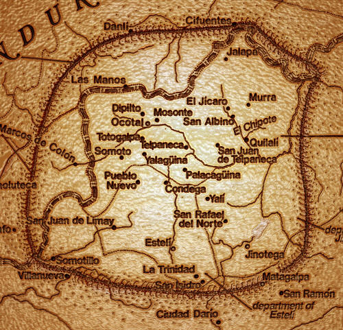
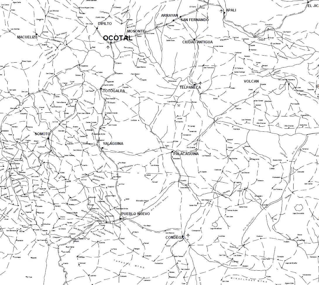
Map 1A.
Ocotal-Condega Area. Chunk
of the above PDF/MapInfo map, made using
"Tools > Select & Zoom > Snapshot Tool".
This & the map to follow included only
as examples; the problem is that turning
a chunk of the PDF/MapInfo map into a
JPEG file means lower resolution when
you zoom in. © Michael J.
Schroeder.
|
|
|
Map 1B.
Matagalpa-Jinotega Area.
(Chunk of the above PDF/MapInfo map.)
© Michael J. Schroeder.
|
|
|
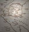
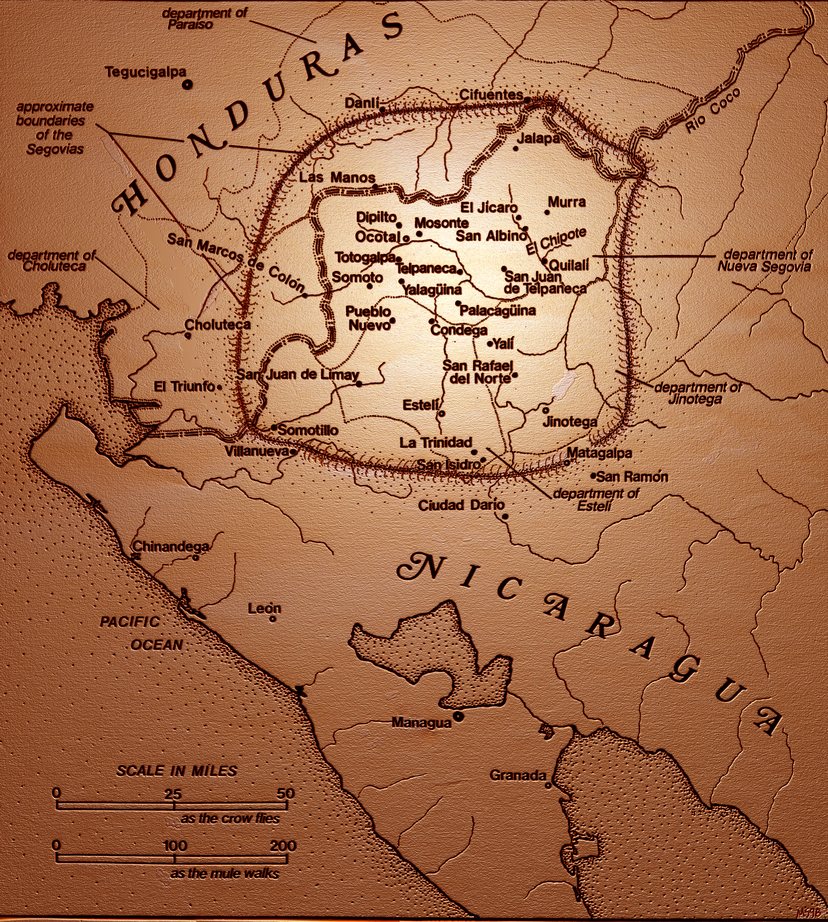
Map 2. Las
Segovias in Western Nicaragua (scan of
original map made using rub-on letters &
a fine-point black pen, along with a
fair amount of liquid paper). 4.5
MB. © Michael J. Schroeder.
|
|
|
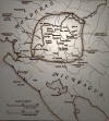
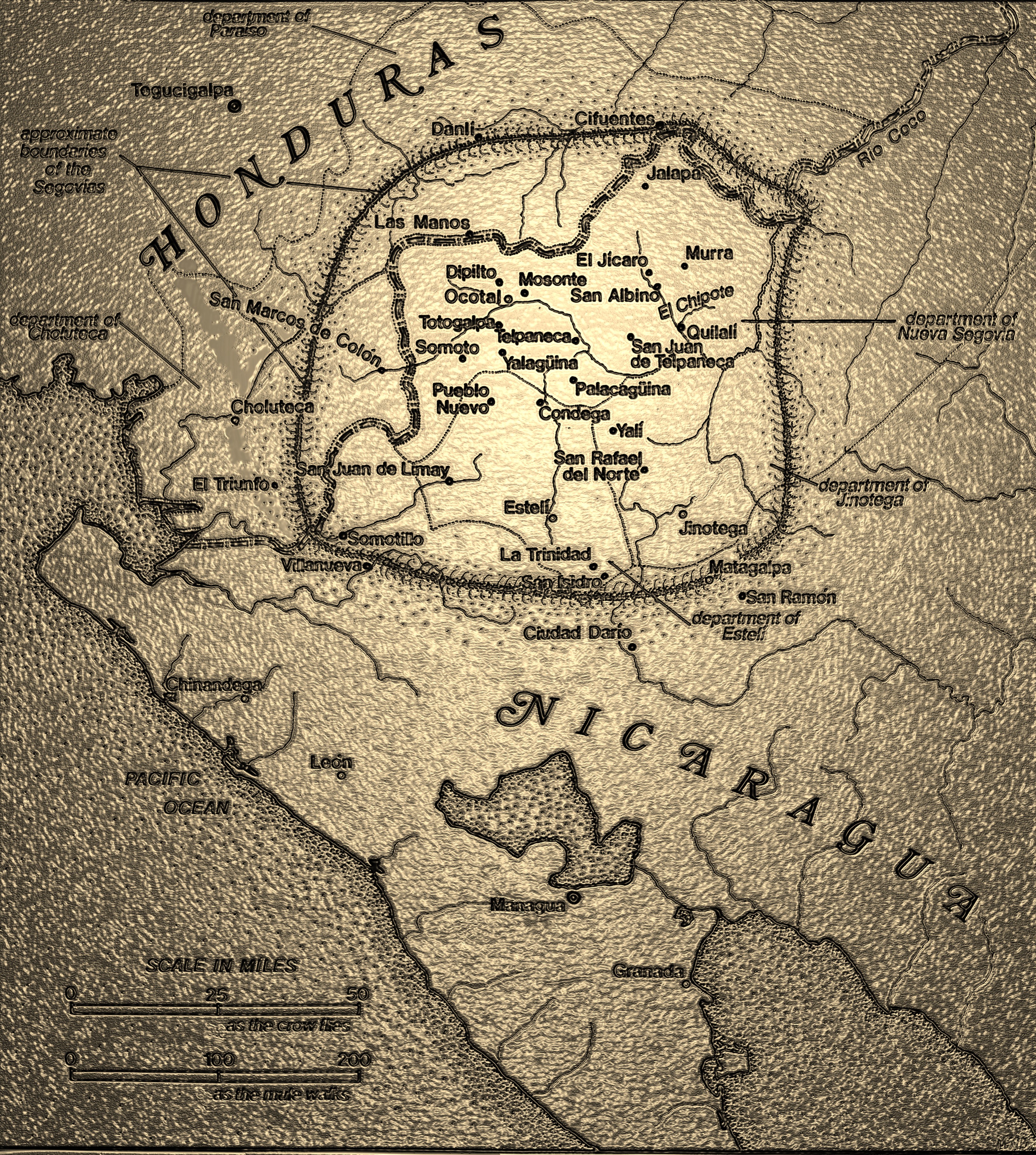
Map 2A. Las
Segovias in Western Nicaragua,
Photoshopped Version #1. 6.2 MB.
© Michael J. Schroeder.
|
|
|
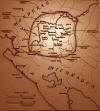
Map 2B. Las
Segovias in Western Nicaragua,
Photoshopped Version #2. 10 MB.
© Michael J. Schroeder.
|
|
|
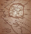
Map 2C. Las
Segovias in Western Nicaragua,
Photoshopped Version #3. 12.7 MB.
© Michael J. Schroeder.
|
|
|
Map 2D. Las
Segovias in Western Nicaragua,
Photoshopped Version #4. 4.1 MB.
© Michael J. Schroeder.
|
|
|
Map 2E. Las
Segovias in Western Nicaragua,
Photoshopped Version #5. 4.8 MB.
© Michael J. Schroeder.
|
|

|
Map 2F. Las
Segovias in Western Nicaragua,
Photoshopped Version #6. 1.4 MB.
© Michael J. Schroeder.
|
|
_small.jpg)
|
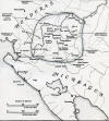
Map 3. Las
Segovias and adjacent zones, showing
airfields built 1927-1934.
Adapted from
US Army Map, Geographic Intelligence,
Military Intelligence Division (G-2),
1934. 1.5 MB. © Michael J. Schroeder.
|
|
|
|
|


.jpg)