|
.jpg) This
page houses the map
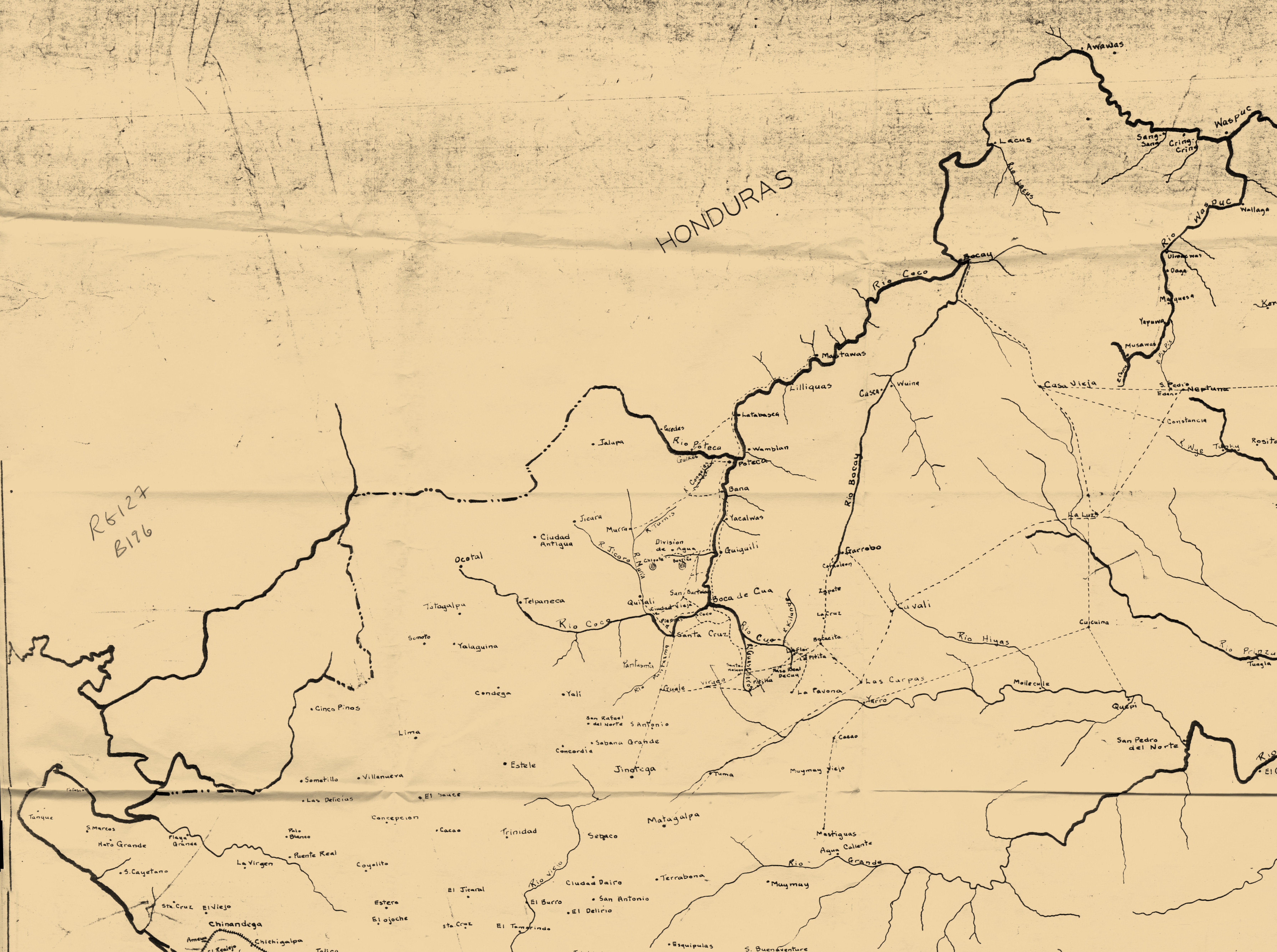
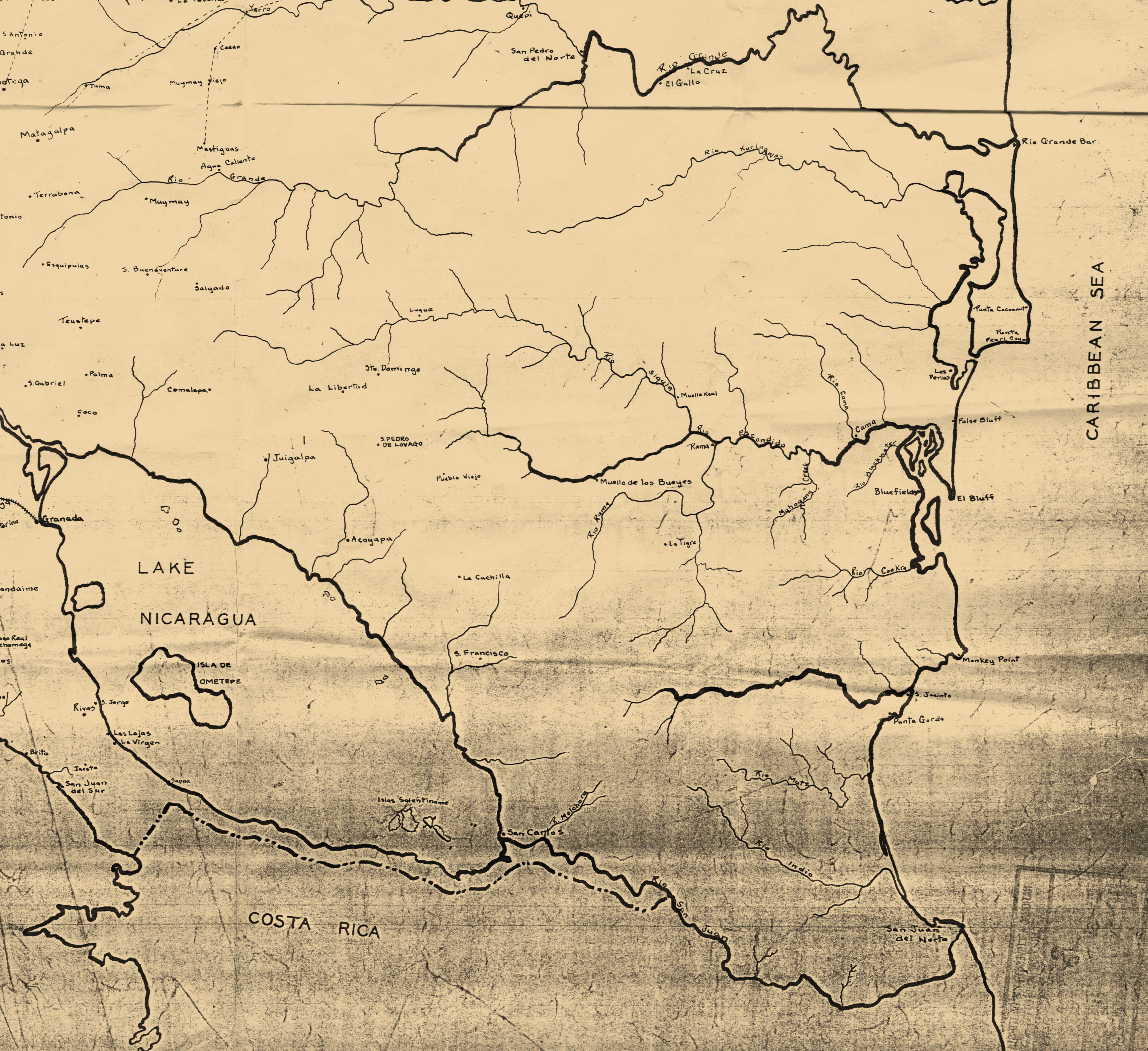
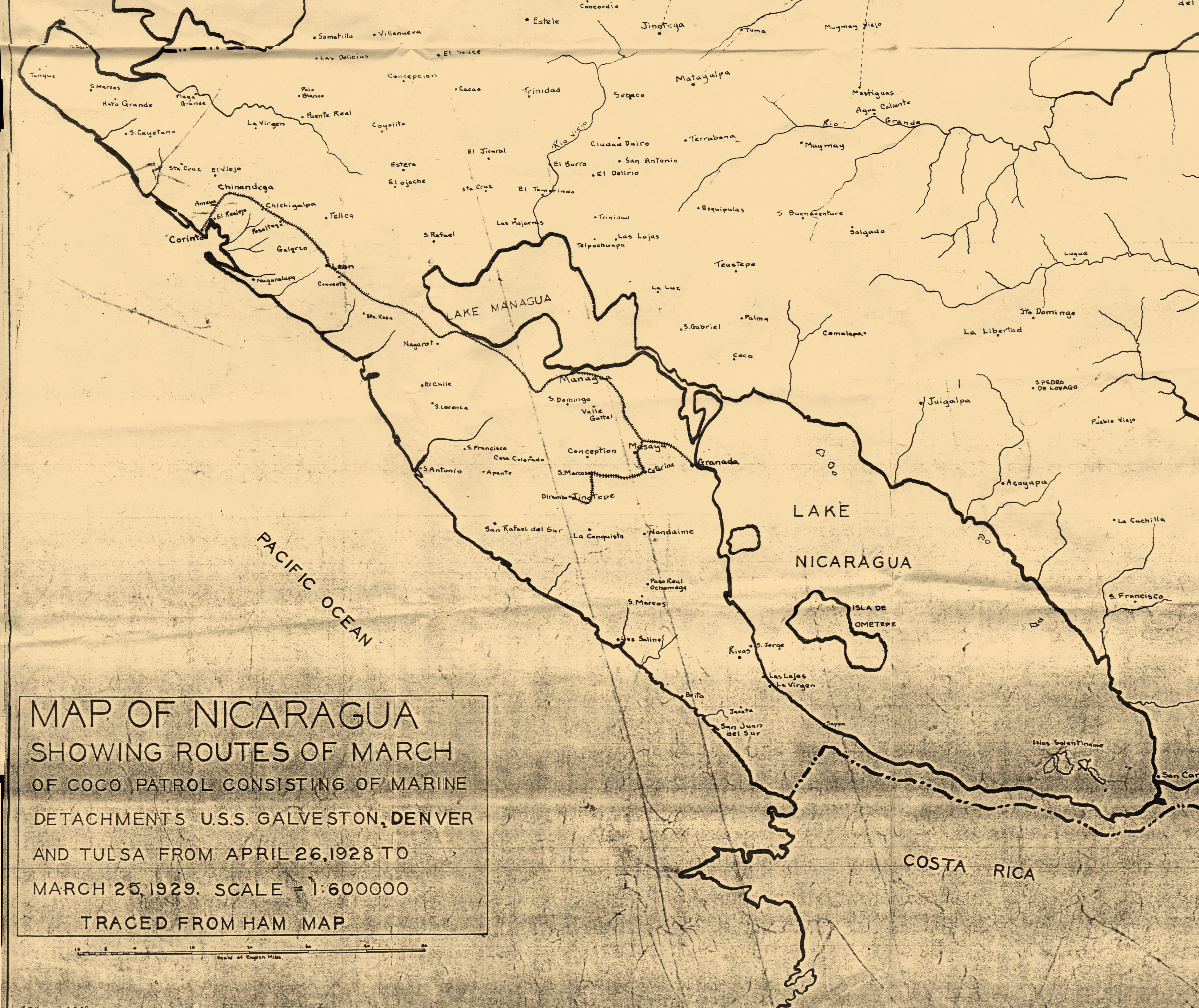
described on the title & legend at right — the route of
the quasi-legendary Río Coco patrol led by Capt.
Merritt A. "Red Mike" Edson in 1928-29, as so
ably examined by David C. Brooks in his 1989
JLAS article. Traced
from the 1924 Clifford Ham map, and measuring 35
inches high x 32 inches wide, the map is
housed in RG127/196, and should be read in
combination with the series of telegrams and
reports on the Río Coco Patrol housed in the
EAST COAST
PAGES. The map
presented here is a panoramic stitch of scans
of a photocopy. This
page houses the map
described on the title & legend at right — the route of
the quasi-legendary Río Coco patrol led by Capt.
Merritt A. "Red Mike" Edson in 1928-29, as so
ably examined by David C. Brooks in his 1989
JLAS article. Traced
from the 1924 Clifford Ham map, and measuring 35
inches high x 32 inches wide, the map is
housed in RG127/196, and should be read in
combination with the series of telegrams and
reports on the Río Coco Patrol housed in the
EAST COAST
PAGES. The map
presented here is a panoramic stitch of scans
of a photocopy.
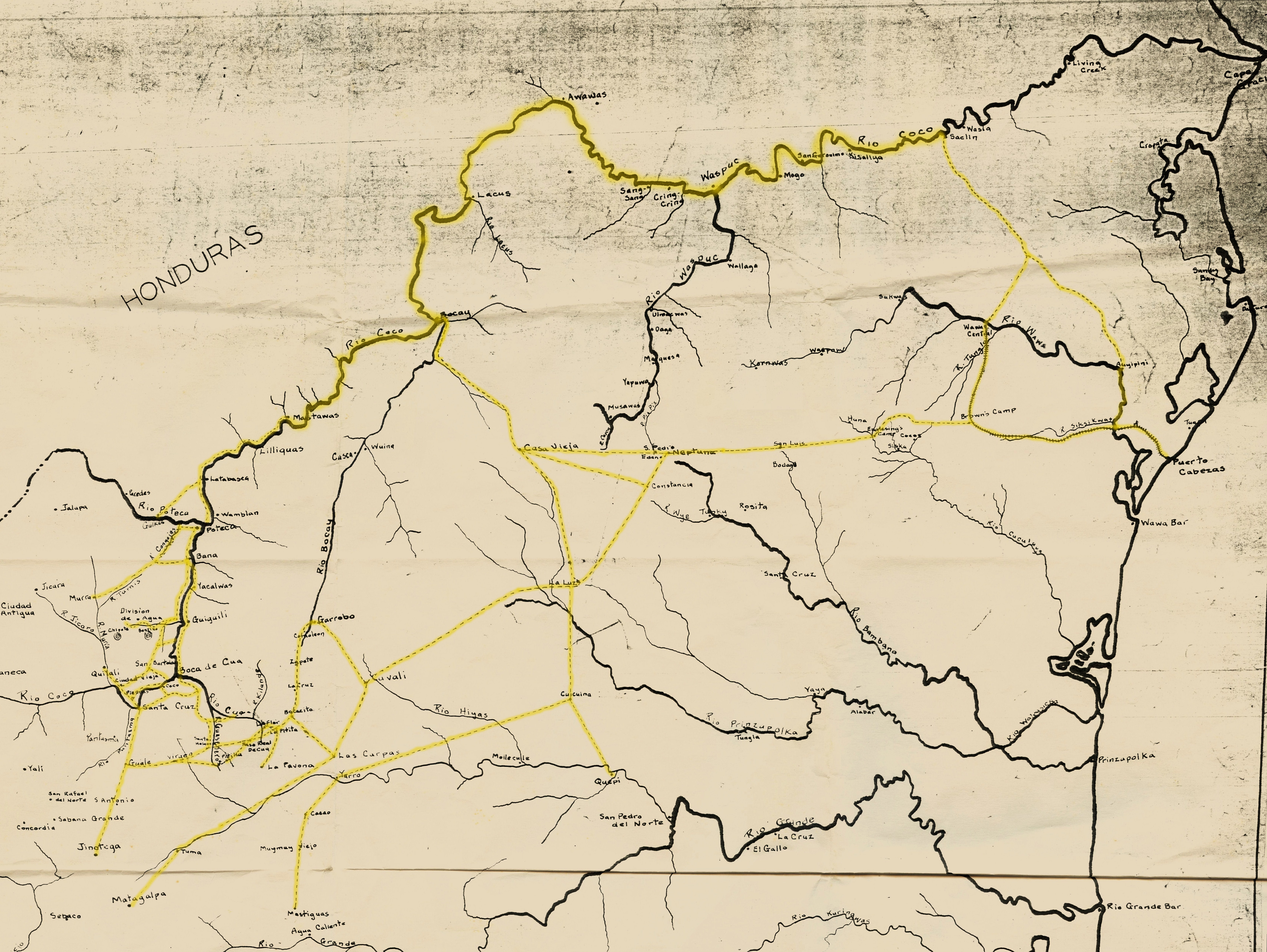
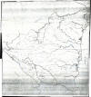
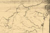
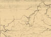
The first image
shows the whole map (43MB). The next four images show the NE,
NW, SE, and SW quadrants in JPEG
files of around 5 MB each.
The next image highlights the route of march in
yellow.
|
|
Entire map (43 MB).
|
|
|
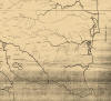
Northeast quadrant,
from Cabo Gracias a Dios & Puerto
Cabezas all the way to Quilalí and the
northeastern Segovias, and showing most
all the route of march (4.7 MB).
|
|
|
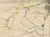
Northwest quadrant.
|
|
|
Southeast quadrant.
|
|
|
Southwest quadrant,
with map title and scale.
|
|
|
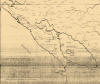
Route highlighted in yellow.
|
|