|
 This
PAGE HOUSEs maps of nicaraguan cities, townS &
Mining districts,
most produced from the mid-1920s to the early 1930s, most by the Marines &
Guardia (with the first map of Bluefields dating
to 1910). The collection includes: This
PAGE HOUSEs maps of nicaraguan cities, townS &
Mining districts,
most produced from the mid-1920s to the early 1930s, most by the Marines &
Guardia (with the first map of Bluefields dating
to 1910). The collection includes:
•
Bluefields
(1910 & CA. 1926)
•
Chinandega
•
Condega
•
Corinto Harbor
•
Estelí
•
Granada
•
Jalapa
•
Jinotega
•
la luz / siuna mining district
•
La trinidad
•
León
•
Managua
•
Masaya
•
Matagalpa
•
Ocotal
•
Nandaime
•
pis pis / Neptune mining district
•
Pueblo Nuevo
•
Puerto Cabezas (Bragmans Bluff
Lumber Co., with ACCOMPANYING photo)
•
San Francisco del Carnicero
•
Santo dominto—javalÍ, chontales
•
San Rafael del Norte
•
somoto
•
Telpaneca
•
Photo: Danlí,
Honduras, 1927. RG127, US National
Archives
|
|
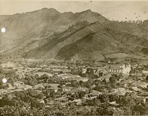
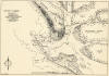
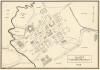
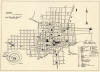
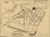
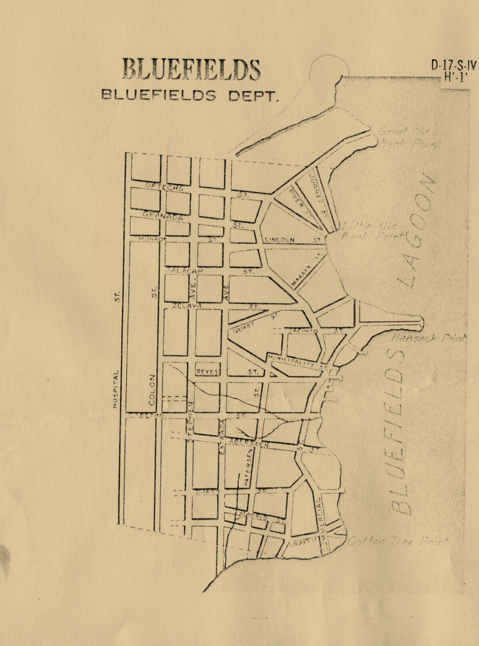
Bluefields
(1910)
"Compass and Board Survey of
Bluefields," by the US Marine Corps,
1910, with street names and principal
buildings indicated. From the US
National Archives, Record Group 127,
Entry 38, Box 31.
|
|
|
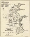
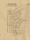
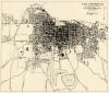
Bluefields
(ca. 1926)
Unknown source & provenance, c. 1926;
found among the David C. Brooks
dissertation research materials, with no
source indicated; likeliest source:
the Harold H. Utley Papers or the
Merritt A. Edson Papers, Library of
Congress.
|
|
|
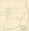
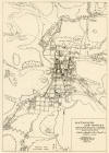
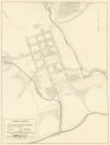
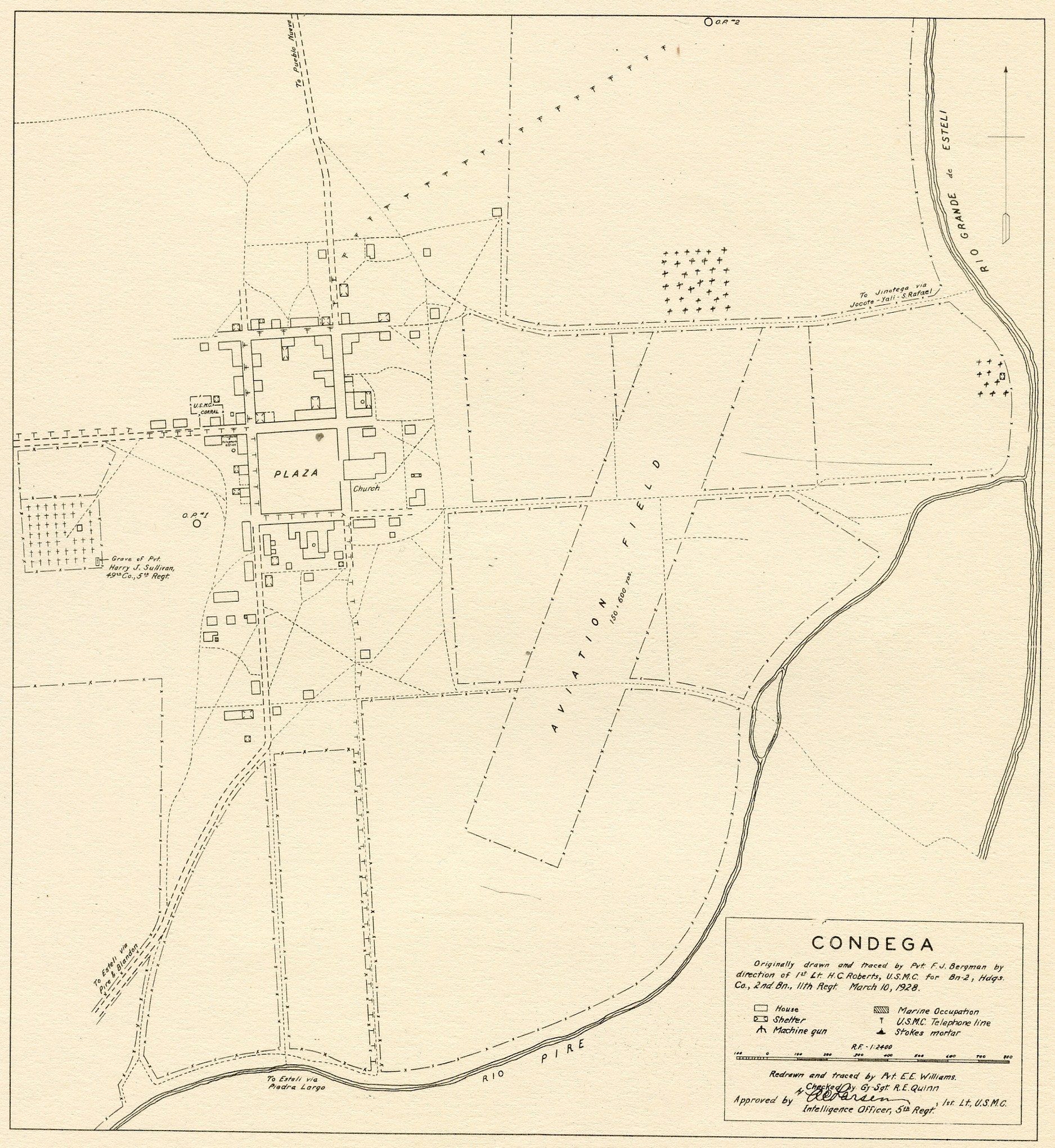
Condega
(1928)
10 March 1928: "Originally drawn and
traced by Pvt. F. J. Bergman by
direction of 1st Lt. H. C. Roberts,
U.S.M.C. for Bn-2, Hdqs. Co., 2nd Bn.,
11th Regt., March 10, 1928.
Redrawn & retraced by Pvt. E. E.
Williams, checked by Gy-Sgt. R. E.
Quinn, Approved by 1st Lt. A. C. Larsen,
1st Lt., U.S.M.C., Intelligence Officer,
5th Regt., March 10, 1928."
|
|
|
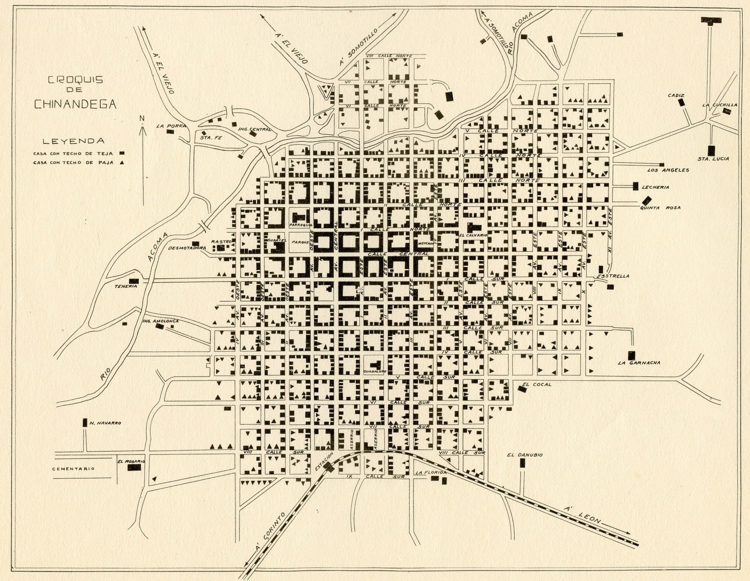
Chinandega
(ca. 1931)
Author & date of production unknown; ca.
1931.
|
|
|
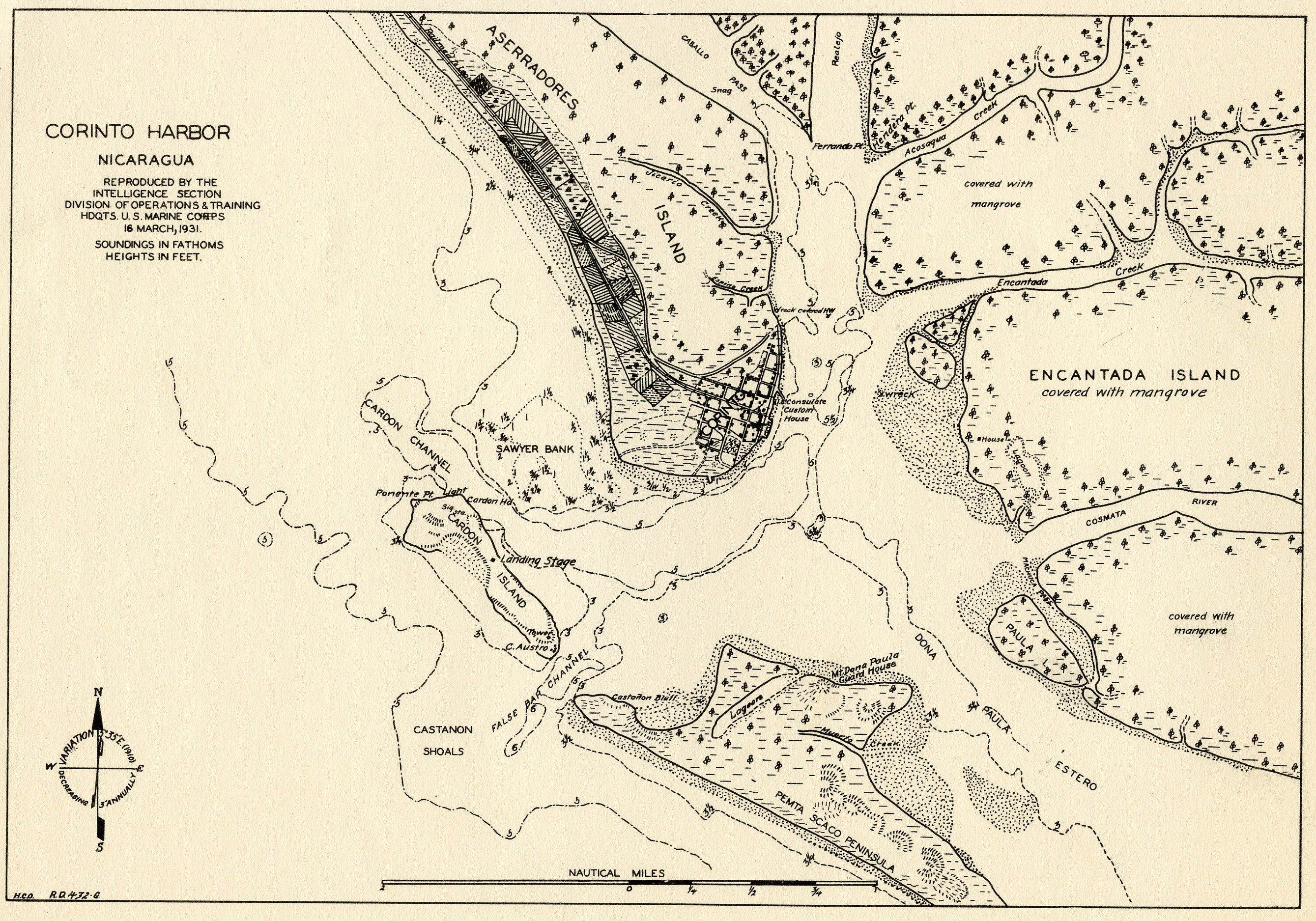
Corinto Harbor
(1931)
16 March 1931. "Reproduced by the
Intelligence Section, Division of
Operations & Training, Hdquts. U.S.
Marine Corps"
|
|
|
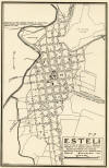
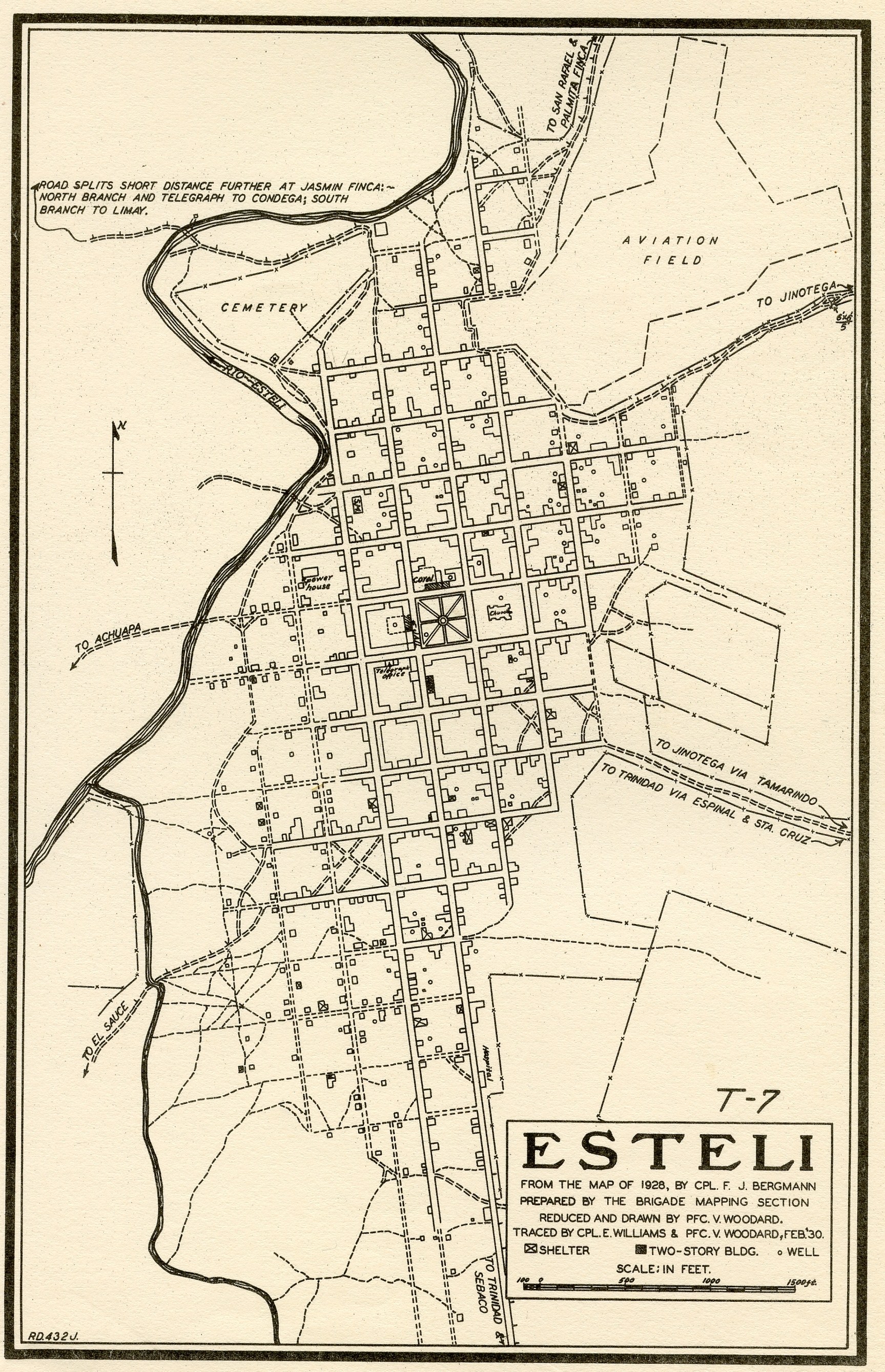
Estelí
(1930)
"From the
Map of 1928, by Cpl. F. J. Bergmann,
Prepared by the Brigade Mapping Section,
Reduced & Drawn by PFC. V. Woodard,
Traced by Cpl. E. Williams & Pfc. V.
Woodward, Feb. 1930"
|
|
|
Granada
(ca. 1925)
"Mapa de Granada y Sus Alrededores, Para
el Saneamienta de la ciudad, con datos
tomados de mapas existentes y con datos
recogidos en el campo por el
Departamento de Uncinariasis" (con datos
de Septiembre de 1923 hasta Junio de
1925)
|
|
|
Jalapa
(1929)
"Traced in Brigade Mapping Section, 30
July 1929"
|
|
|
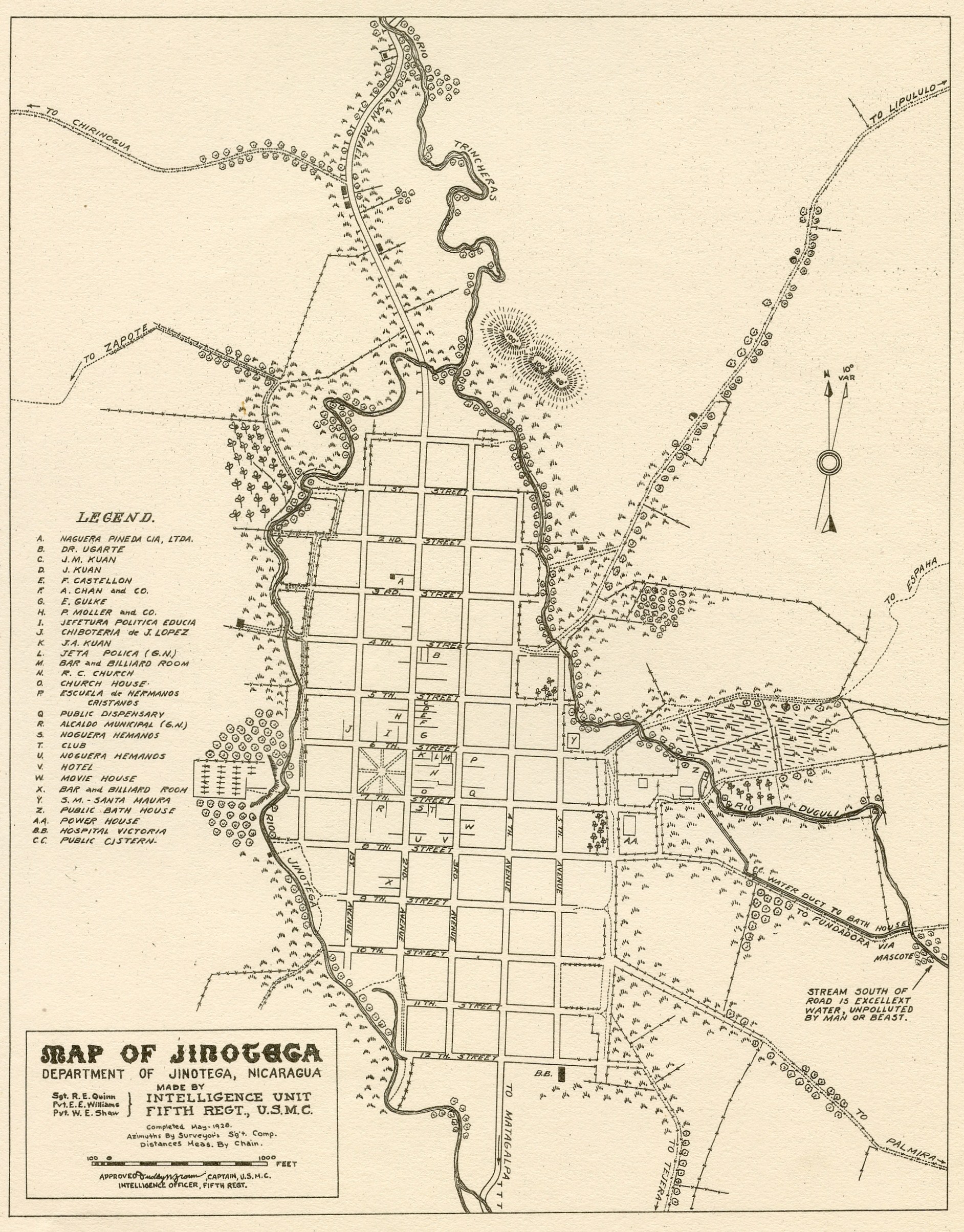
Jinotega
(1928)
"Made by Intelligence Unit, Fifth Regt.,
U.S.M.C., Sgt. R. E. Quinn, Pvt. E. E.
Williams, Pvt. W. E. Shaw, Approved by
Dudley W. Brown, Captain, U.S.M.C.,
Completed May 1928"
|
|
|
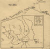
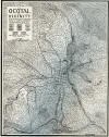
La Luz / Siuna Mining District
(1929)
"Vicinity of La Luz from sketch by H. B.
Alban, 1st Lt., USMC, July 1929," detail
of "Skeleton Map of Northeast
Nicaragua", 16 March 1930. A
separate web page houses this
fascinating hybrid Skeleton Map,
HERE. For
additional maps of the mining districts,
see the Mining Districts Map Collection,
HERE.
|
|
|
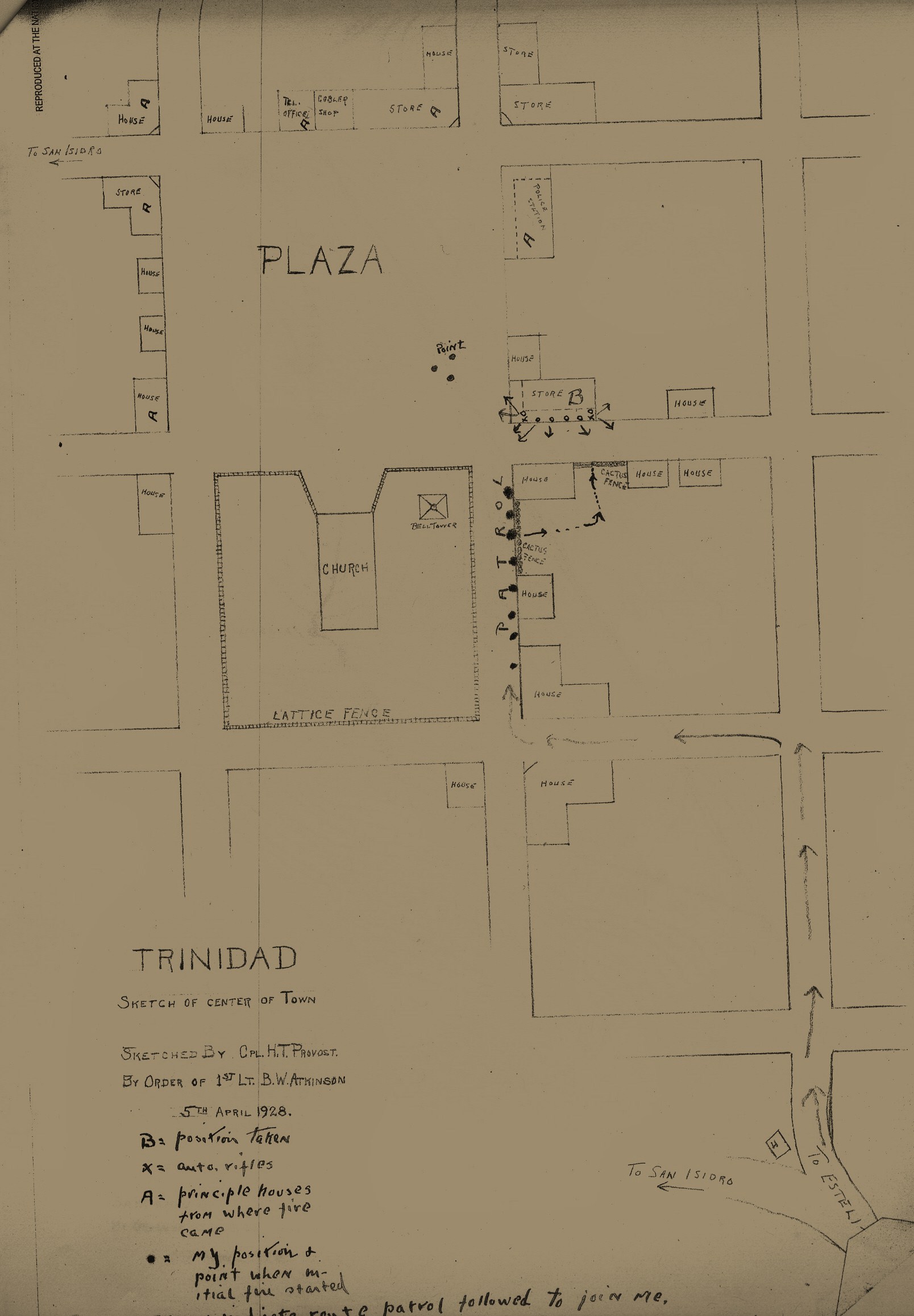
La Trinidad (1928)
Map acccompanying "Report of Patrol to
Trinidad," 1st Lt. B. W. Atkinson,
U.S.M.C., 5 April 1928, housed as
pc-doc 28.04.05.
|
|
|
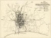
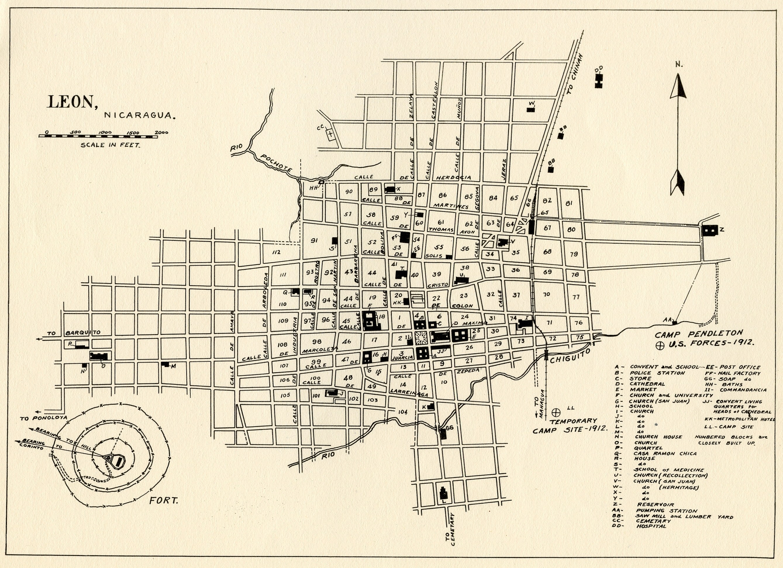
León
(ca. 1931)
No author or date indicated, 2nd Brigade
Mapping Section, ca. 1931.
|
|
|
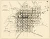
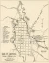
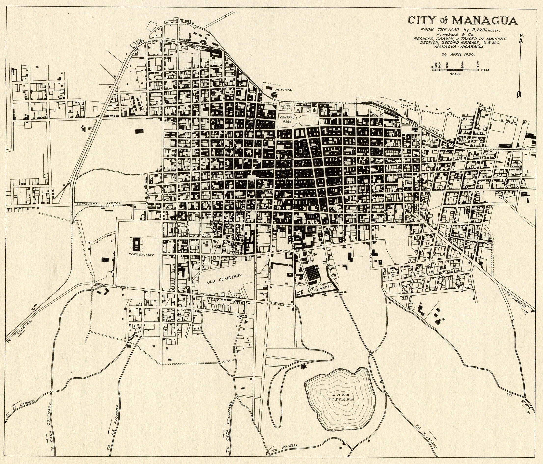
Managua
(1930)
"City of Managua, From the Map by R.
Keilhauser, R. Hebard & Co., Reduced,
Drawn & Traced in Mapping Section,
Second Brigade, U.S.M.C., Managua,
Nicaragua, 26 April 1930"
|
|
|
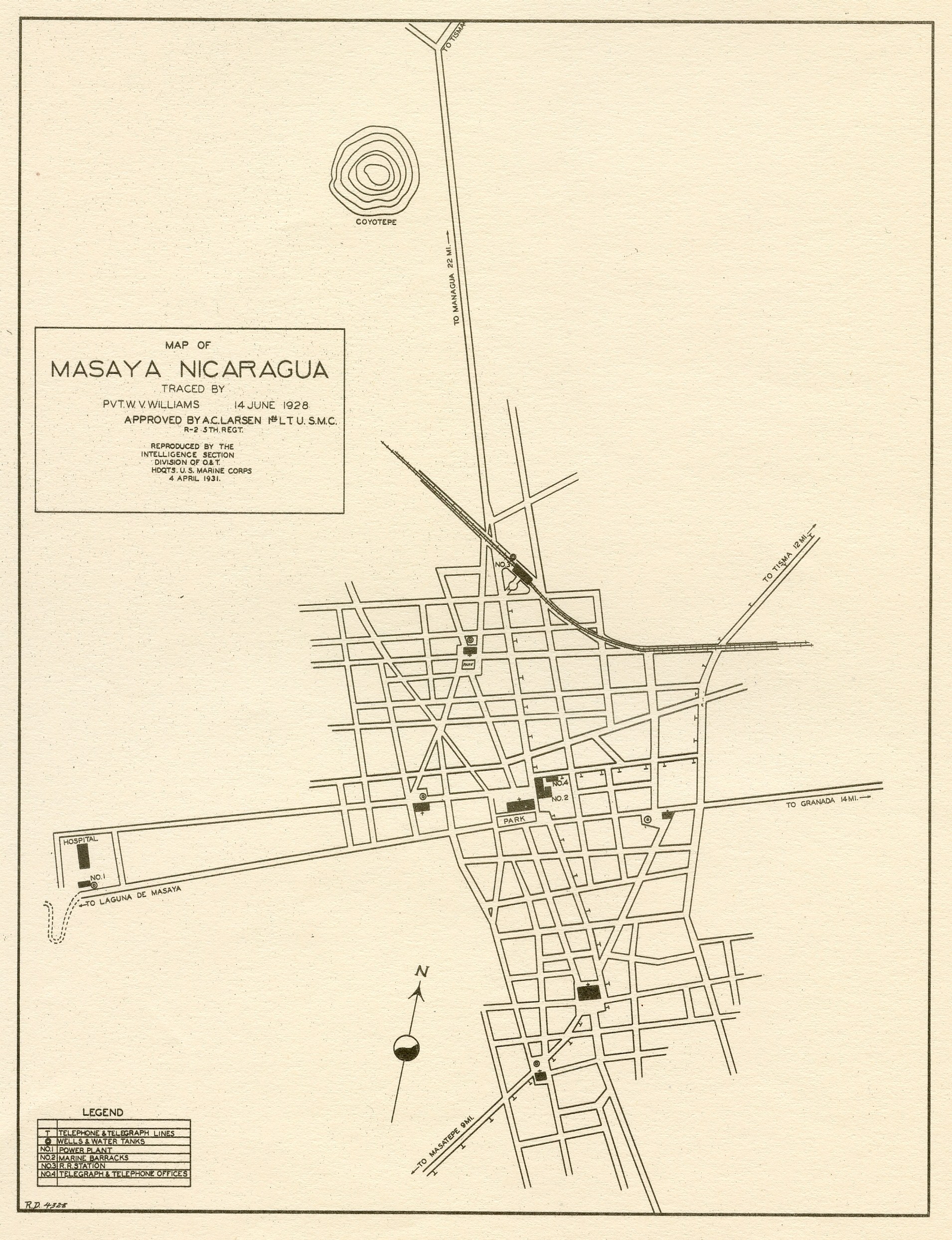
Masaya
(1928)
"Map of Masaya, Nicaragua, Traced by
Pvt. W. V. Williams, 14 June 1928,
Approved by A. C. Larsen, 1st Lt.,
U.S.M.C., R-2, 5th Regt., Reproduced by
the Intelligence Section, Division of O.
& T., Hdquts. U.S. Marine Corps, 4 April
1931"
|
|
|
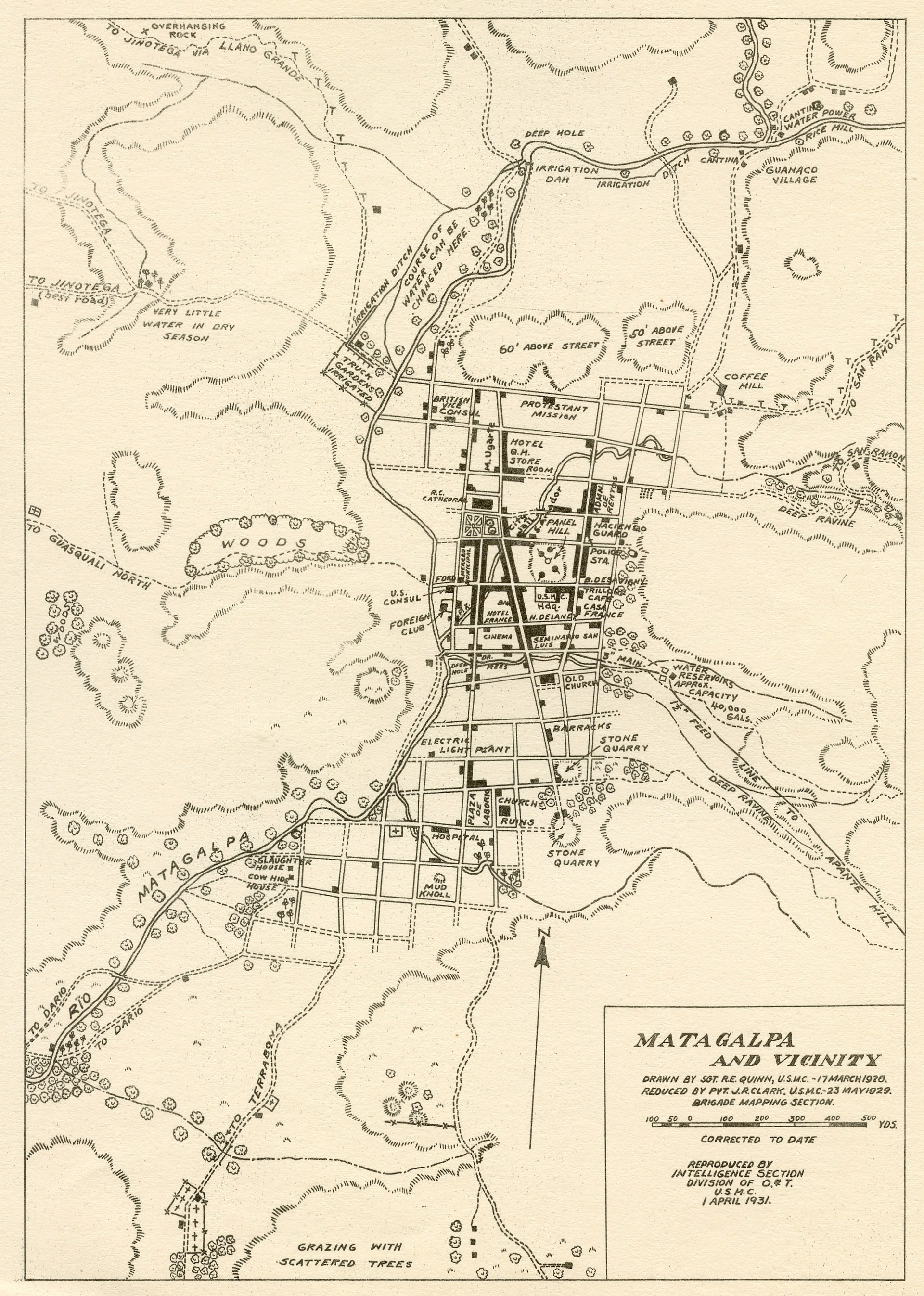
Matagalpa
(1931)
"Matagalpa & Vicinity, Drawn by Sgt. R.
E. Quinn, U.S.M.C., 17 March 1928.
Reduced by Pvt. J. R. Clark, U.S.M.C.,
23 May 1929, Brigade Mapping Section,
Corrected to Date, Reproduced by
Intelligence Section, Division of O. &
T., U.S.M.C., 1 April 1931"
|
|
|
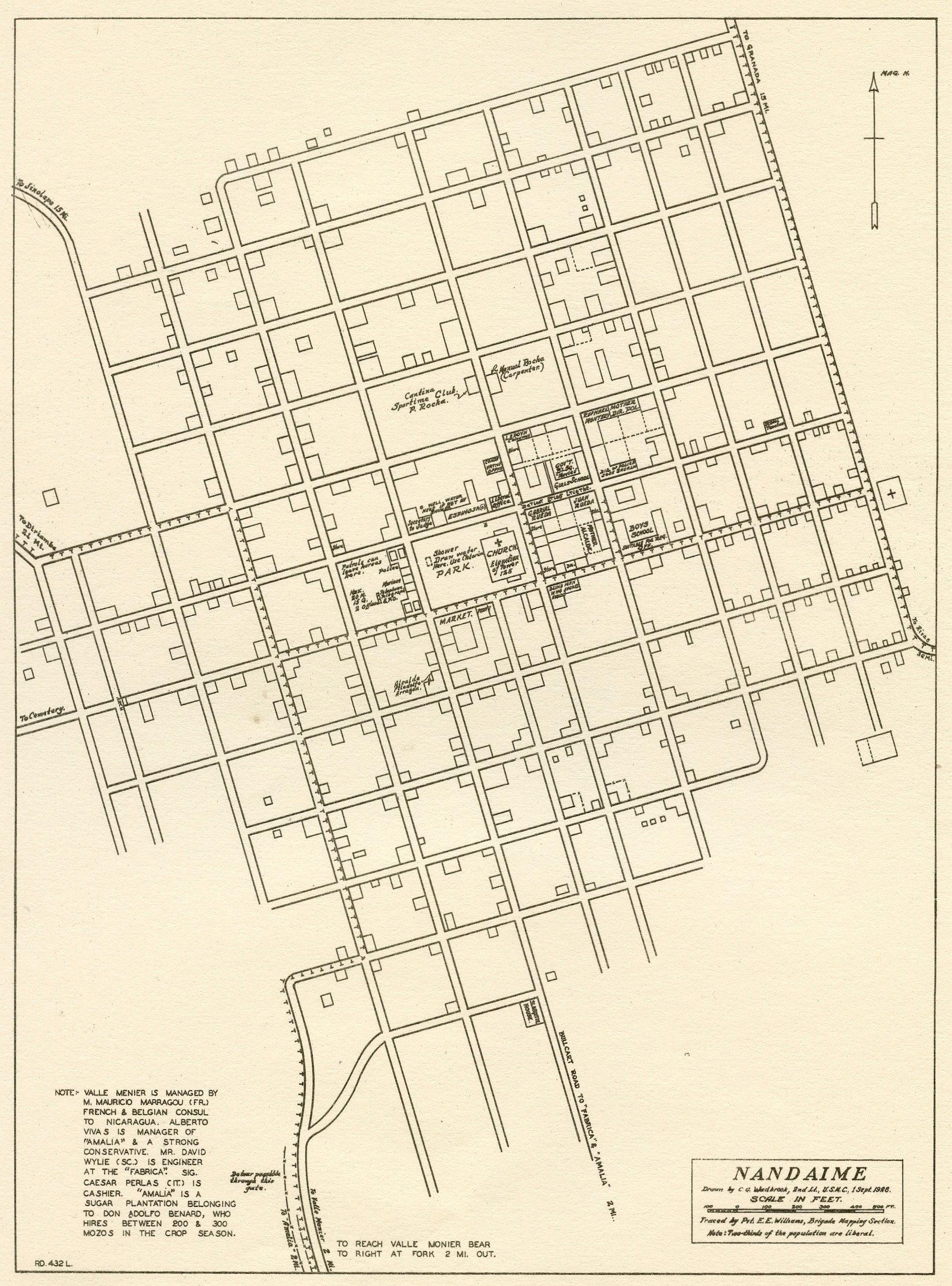
Nandaime
(1928)
"Nandaime, Drawn by C. G. Wadbrook, 2nd
Lt. U.S.M.C., 1 Sept. 1928. Traced by
Pvt. E. E. Williams, Brigade Mapping
Section"
|
|
|
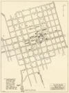
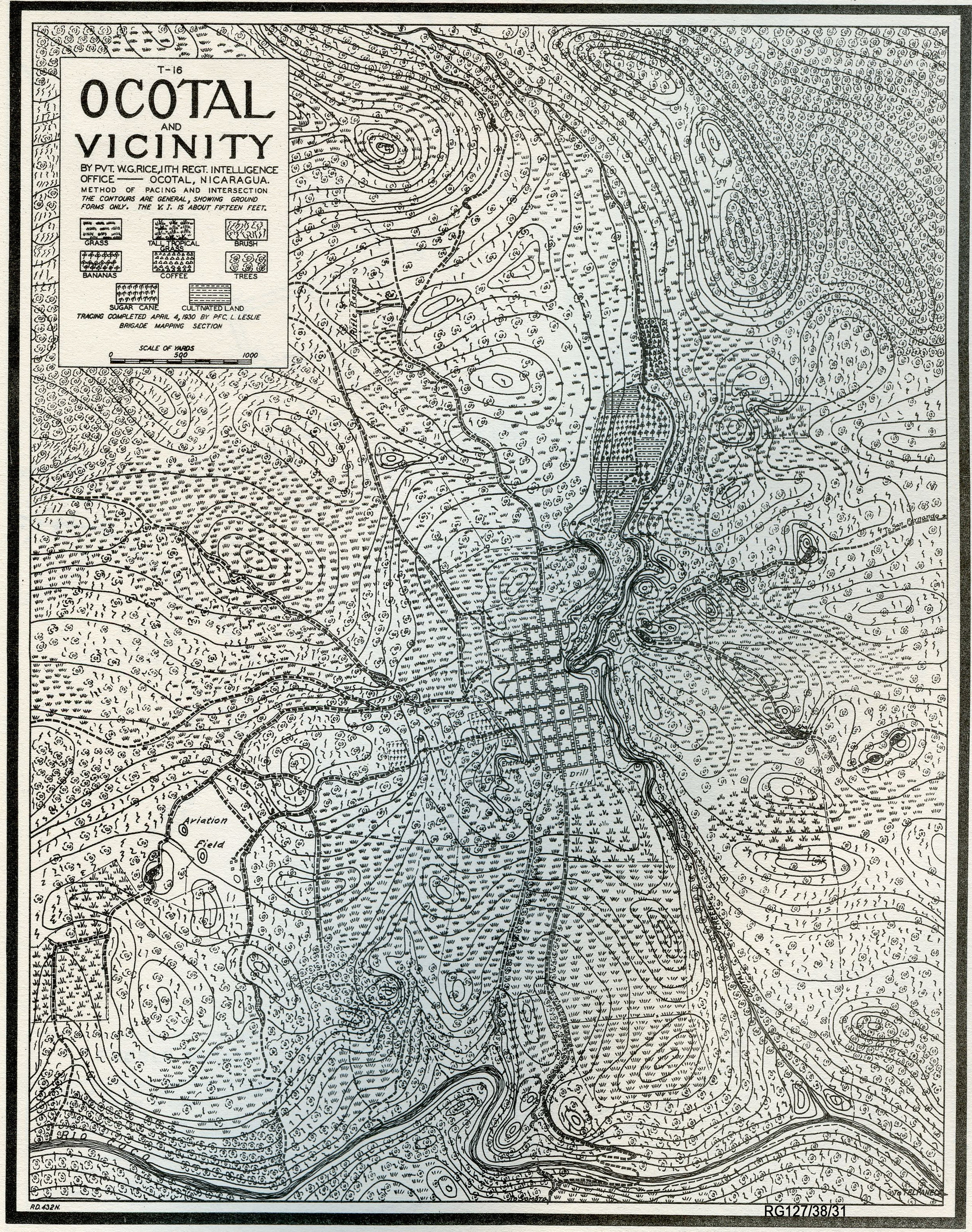
Ocotal
(1928)
"Ocotal and Vicinity, by Pvt. W. G.
Rice, 11th Regt. Intelligence Office,
Tracing Completed April 4, 1930 by PFC
L. Leslie, Brigade Mapping Section."
RG127/38/31.
|
|
|
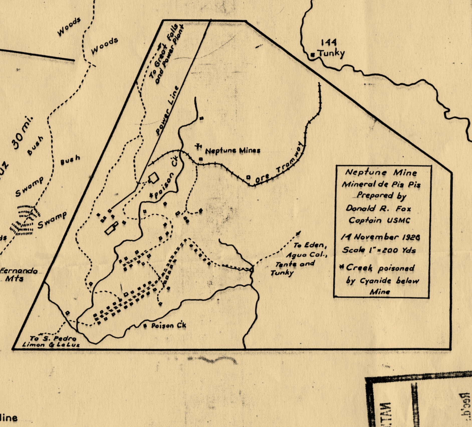
Pis Pis / Neptune Mining District
(1928)
"Neptune Mine, Mineral de Pis Pis,
Prepared by Donald R. Fox, Captain USMC,
14 November 1928, scale 1" = 200 yds,
*Creek poisoned by Cyanide below mine."
This map is a detail of "Skeleton Map of
Northeast Nicaragua", 16 March 1930.
A separate web page houses this
Skeleton Map. See also the
Mining Districts Map Collection.
|
|
|
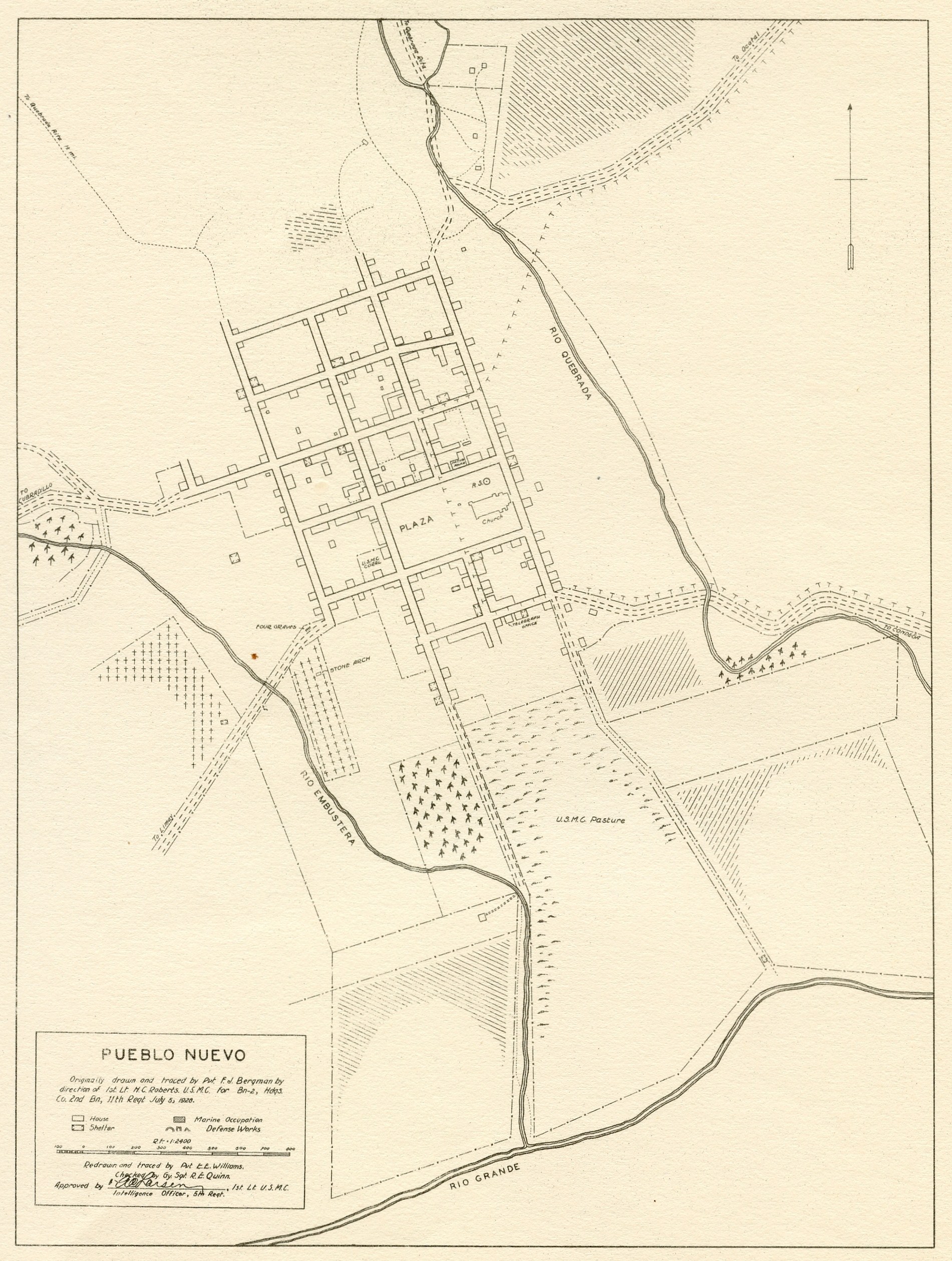
Pueblo Nuevo
(1928)
"Originally drawn & traced by Pvt. Fcl.
Bergman by direction of 1st Lt. H. C.
Robberts, U.S.M.C. for Bn-2, Hdqs. Co.
2nd Bn, 11th Regt, July 5, 1928.
Redrawn & traced by Pvt. E. E. Williams,
Checked by Gy. Sgt. R. E. Quinn,
Approved by A. C. Larsen, 1st Lt.
U.S.M.C., Intelligence Officer, 5th
Regt."
|
|
|
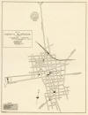
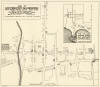
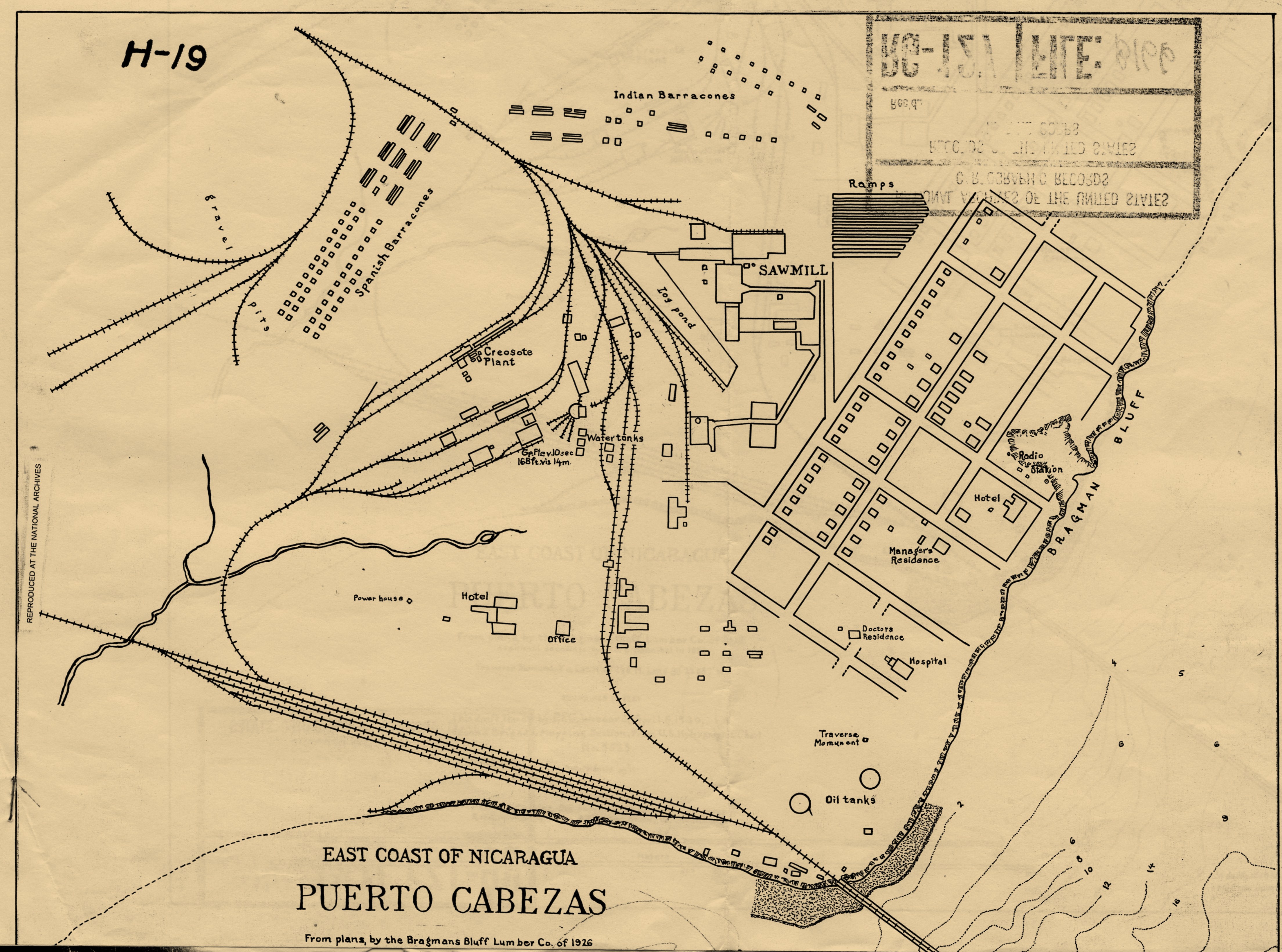
Puerto Cabezas (1926)
Produced
by Bragmans Bluff Lumber Co. This is a fascinating
and important map. Especially
notable are the spatially segregated
living quarters, with the "Spanish
Barracones" and "Indian Barracones"
separated by a railroad track.
Only three short blocks separate the
Caribbean Sea from company property,
which completely dominates the town.
Here is the description of Puerto
Cabezas in the
Monograph of
Nicaragua: "[Puerto Cabezas]
and Bluefields are the leading towns and
seaports on the east coast of Nicaragua.
Puerto Cabezas is almost entirely by the
Standard Fruit Company. This company
employs the greater part of the town’s
population in its fruit exporting
business. The large lumber mill located
in this town and operated by the same
company. . . . It is expected that
the town will shrink to a small village
of no importance when the Standard Fruit
Company ceases its activities here. The
town was built by the Bragmans Bluff
Lumber Company to house their employees.
It is of no military importance nor
naval importance . . .
|
|
_small.jpg)
|
Puerto Cabezas
(photograph, 1928)
Photograph of "Puerto Cabezas" taken
in 1928 by
Pfc. Fred Nelson. This is probably
the row of houses built for the white
managerial staff, adjacent to the "ramp"
and "sawmill" running northeast out of
town on the map above. From a
photo album purchased on eBay, collection of
Michael J. Schroeder.
|
|
|
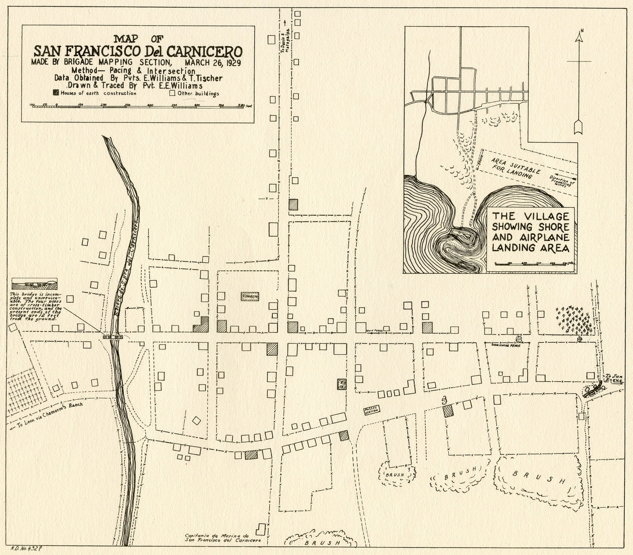
San Francisco del Carnicero
(1929)
"Made by Brigade Mapping Section, March
26, 1929. Method: Pacing &
Intersection. Data obtained by
Pvts. E. Williams & T. Tischer, Drawn &
Traced by Pvt. E. E. Williams"
|
|
|
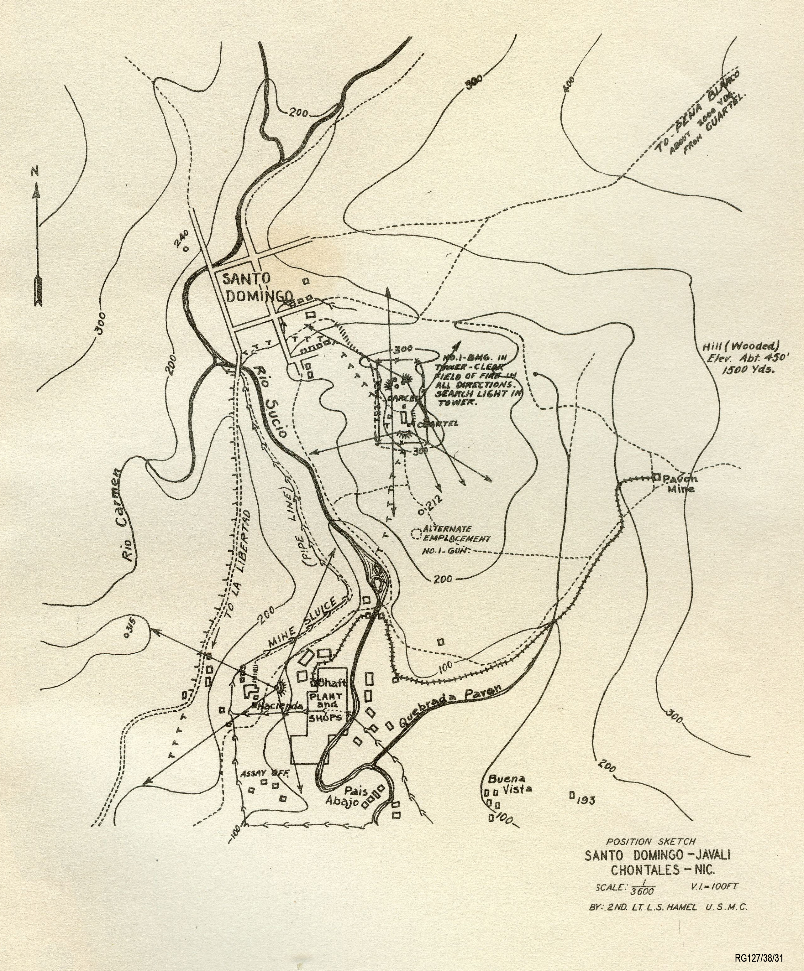
Santo
Domingo — Javalí, Chontales
(ca. 1930)
"Position Sketch Santo Domingo - Javali
Chontales - Nic, by 2nd Lt. L. S. Hamel,
U.S.M.C." RG127/38/31.
|
|
|
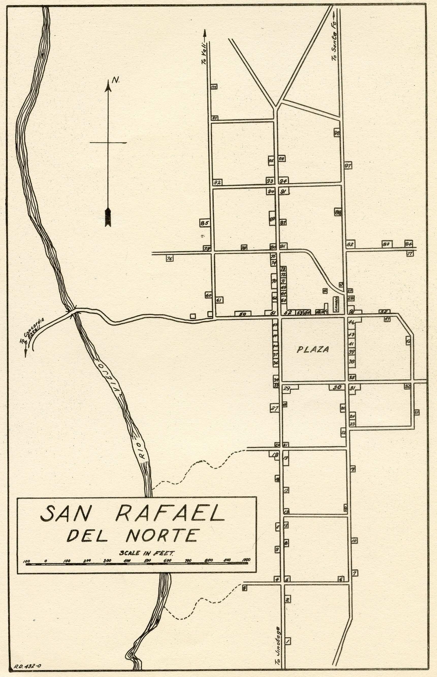
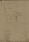
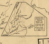
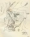
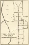
San Rafael del Norte
(ca. 1928)
No date or author indicated, notation
"R.D. 432-0", ca. April 1928. The
key to the numerical symbols has not
been found, but really ought to be.
With the key this map would offer an
unprecedented look at who lived where &
who owned what properties in the town
that occupies such a special place in
the history of the Sandino rebellion.
|
|

|
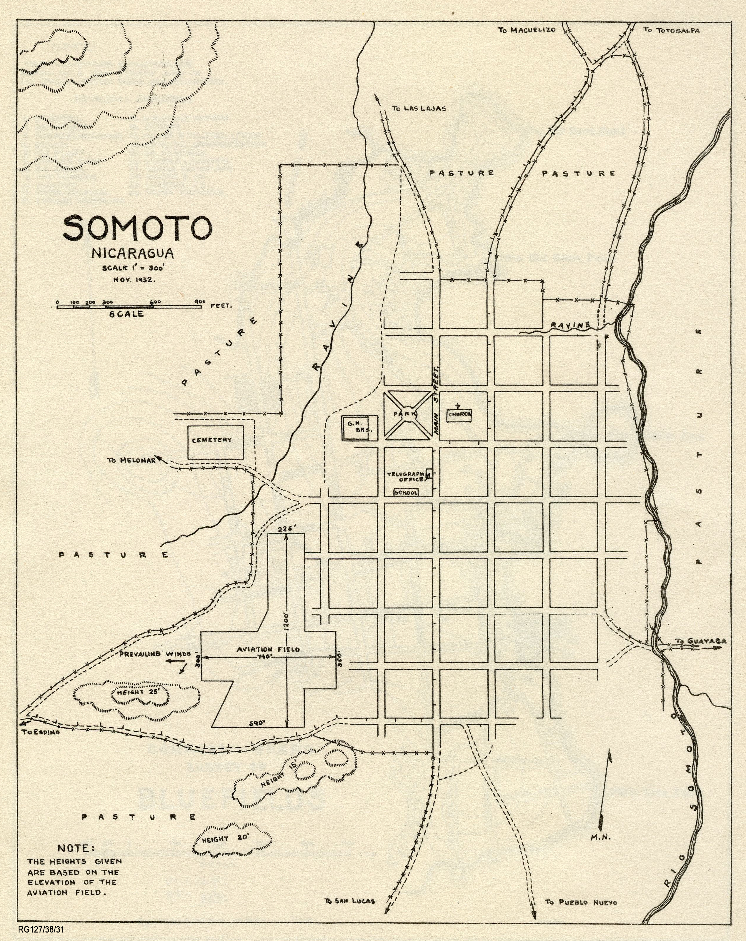
Somoto
(Nov. 1932)
Record Group 127, Entry 38, Box 31.
|
|
|
Telpaneca
(1927)
Map accompanying the report of the
"Telpaneca Attack" of 19 September 1927,
with statements of participants &
eyewitnesses, Capt. R. W. Peard, 22
September 1927. See
PC-DOC 27.09.22.
|
|
|
|
|
|
|
|


.jpg)